Area Overview for N19 3EG
Photos of N19 3EG


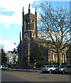
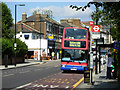
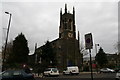
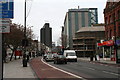
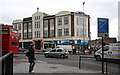

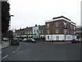
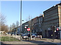

100 photos from this area
Area Information
Key information about the N19 3EG including its size, population, and administrative classification.
- Area Type
- Postcode
- Area Size
- 8112 m²
- Population
- 1886
- Population Density
- 18177 people/km²
House Prices in N19 3EG
81
Properties
£855,956
Average Sold Price
£380,000
Lowest Price
£1,900,000
Highest Price
Showing 81 properties
| Address | Type | Beds | Baths | Last Sale Price | Last Sale Date | |
|---|---|---|---|---|---|---|
| 58 St Johns Villas, London, N19 3EG | Terraced | 5 | 1 | £1,900,000 | May 2024 | |
| 18 St Johns Villas, London, N19 3EG | Terraced | 4 | 4 | £1,350,000 | Nov 2023 | |
| 68 St Johns Villas, London, N19 3EG | house | 3 | - | £925,000 | Jun 2021 | |
| 64 St Johns Villas, London, N19 3EG | Terraced | 5 | 2 | £1,295,000 | Jul 2014 | |
| 20 St Johns Villas, London, N19 3EG | Terraced | 4 | 2 | £1,115,000 | Sep 2013 | |
| 60 St Johns Villas, London, N19 3EG | Terraced | 6 | 2 | £1,070,000 | Aug 2013 | |
| 48 St Johns Villas, London, N19 3EG | house | 5 | - | £735,000 | Dec 2011 | |
| 62 St Johns Villas, London, N19 3EG | house | 5 | - | £765,000 | Jul 2011 | |
| 28 St Johns Villas, London, N19 3EG | house | - | - | £1,075,000 | Jul 2008 | |
| 70 St Johns Villas, London, N19 3EG | house | 1 | - | £380,000 | Feb 2008 |
Page 1 of 9
Energy Efficiency in N19 3EG
Amenities
Schools
| Rank | School | Type | Entry gender | Ages |
|---|
Explore more schools in this area
Go to Schools tabDemographics
Household Size
One person
most common
Accommodation Type
Flats
most common
Tenure
31
majority
Ethnic Group
White
most common
Religion
N/A
most common
Household Composition
N/A
most common
Age
47
median
Adults (30-64 years)
most common
Household Deprivation
N/A
with no deprivation
NS-SEC
48
in Lower managerial occupations
Explore more demographic insights in this area
Go to Demographics tabPlanning
Planning Constraints
- Flood RiskPremium
- Ramsar Wetland SitesPremium
- Area of Outstanding Natural BeautyPremium
- Protected Nature ReservePremium
- Protected WoodlandPremium