Area Overview for N19 3DP
Photos of N19 3DP

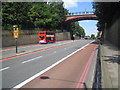
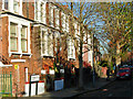
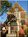
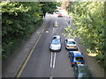
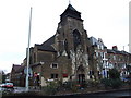
100 photos from this area
Area Information
Key information about the N19 3DP including its size, population, and administrative classification.
- Area Type
- Postcode
- Area Size
- 4315 m²
- Population
- 1736
- Population Density
- 19140 people/km²
House Prices in N19 3DP
48
Properties
£289,063
Average Sold Price
£147,500
Lowest Price
£385,000
Highest Price
Showing 48 properties
| Address | Type | Beds | Baths | Last Sale Price | Last Sale Date | |
|---|---|---|---|---|---|---|
| 46 Duncombe Road, London, N19 3DP | Flat | 1 | 1 | £317,500 | Mar 2022 | |
| 36 Duncombe Road, London, N19 3DP | Flat | - | - | £385,000 | Jun 2021 | |
| 72 Duncombe Road, London, N19 3DP | Flat | - | - | £335,000 | Nov 2020 | |
| 14 Duncombe Road, London, N19 3DP | Flat | - | - | £350,000 | Oct 2020 | |
| 6 Duncombe Road, London, N19 3DP | Flat | 1 | 1 | £305,000 | Mar 2020 | |
| 12 Duncombe Road, London, N19 3DP | Flat | - | - | £361,460 | Oct 2018 | |
| 54 Duncombe Road, London, N19 3DP | Flat | - | - | £325,000 | Apr 2018 | |
| 48 Duncombe Road, London, N19 3DP | Flat | - | - | £184,172 | Oct 2011 | |
| 64 Duncombe Road, London, N19 3DP | Flat | - | - | £180,000 | Mar 2007 | |
| 66 Duncombe Road, London, N19 3DP | Flat | 1 | 1 | £147,500 | Jul 2003 |
Page 1 of 5
Energy Efficiency in N19 3DP
Amenities
Schools
| Rank | School | Type | Entry gender | Ages |
|---|
Explore more schools in this area
Go to Schools tabDemographics
Household Size
Family (3-5 people)
most common
Accommodation Type
Flats
most common
Tenure
28
majority
Ethnic Group
White
most common
Religion
N/A
most common
Household Composition
N/A
most common
Age
47
median
Adults (30-64 years)
most common
Household Deprivation
N/A
with no deprivation
NS-SEC
34
in Lower managerial occupations
Explore more demographic insights in this area
Go to Demographics tabPlanning
Planning Constraints
- Flood RiskPremium
- Ramsar Wetland SitesPremium
- Area of Outstanding Natural BeautyPremium
- Protected Nature ReservePremium
- Protected WoodlandPremium