Area Overview for N18 3DG
Photos of N18 3DG


Area Information
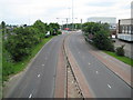
Living in N18 3DG means inhabiting a tightly packed residential cluster in north London, where 1,744 people reside across a densely populated area of just over 1.3 square kilometres. The postcode’s compact size creates a sense of proximity to amenities and transport links, though it remains a small, defined space. Daily life here is shaped by its demographics: a majority of residents are adults aged 30–64, with a median age of 47. This suggests a community of working-age individuals, many of whom may be commuters or professionals. The area’s high population density means limited space for expansion, but its location offers access to multiple transport hubs and retail options. While N18 3DG lacks natural or protected landscapes, its connectivity to nearby towns and cities makes it a practical choice for those prioritising convenience over open spaces. The presence of five rail stations within practical reach, including Angel Road and Meridian Water, ensures easy access to London’s broader transport network. However, the area’s small size means its character is defined by its immediate surroundings, with little room for diversification in lifestyle or environment.
- Area Type
- Postcode
- Area Size
- Not available
- Population
- 1744
- Population Density
- 1293 people/km²
The property market in N18 3DG is characterised by a low home ownership rate of 24%, suggesting that the majority of residents rent their accommodation. This statistic points to a rental market that is likely to dominate, with limited opportunities for long-term property investment. The accommodation type is almost entirely flats, which aligns with the area’s high population density. This means that the housing stock is unlikely to include larger homes or detached properties, making it unsuitable for families requiring more space. For buyers considering this small area, the limited availability of owner-occupied properties may present challenges. The compact nature of N18 3DG also means that property values and availability are closely tied to the surrounding regions. Prospective buyers should be aware that the area’s small size and focus on rental units may restrict options for those seeking to purchase a home.
House Prices in N18 3DG
No properties found in this postcode.
Energy Efficiency in N18 3DG
Life in N18 3DG is shaped by its proximity to a range of amenities within walking or short transit distance. Retail options include major chains such as Tesco Lea, Asda Edmonton, and Aldi Unit 2 Cork Tree Way, ensuring access to groceries and everyday essentials. The area’s transport links are equally strong, with rail stations like Angel Road, Meridian Water, and Edmonton Green providing connections to London’s broader network. Metro stations such as Wood Green and Turnpike Lane add to the ease of commuting, while the Whipps Cross Bus Interchange offers additional flexibility. While the area lacks large parks or leisure facilities, its compact design ensures that residents can access shops, transport, and services without long journeys. The presence of multiple retail and transport hubs suggests a community focused on convenience, though the absence of natural or recreational spaces may be a drawback for those prioritising green spaces.
Amenities
Schools
| Rank | School | Type | Entry gender | Ages |
|---|
Explore more schools in this area
Go to Schools tabDemographics
The community in N18 3DG is predominantly composed of adults aged 30–64, with a median age of 47. This suggests a population largely in their prime working years, which may influence local employment patterns and service demand. Only 24% of residents own their homes, indicating a rental market that dominates the area. The accommodation type is almost exclusively flats, reflecting the high population density of 1,293 people per square kilometre. This density, combined with the flat-based housing stock, implies a lack of larger family homes or detached properties. The predominant ethnic group is Black, which shapes the cultural and social fabric of the area. While no deprivation data is provided, the low home ownership rate and high density may indicate economic pressures or a transient population. The age profile suggests a community with established careers and family structures, though the absence of data on household composition or income levels limits deeper analysis of quality of life factors.
Household Size
Accommodation Type
Tenure
Ethnic Group
Religion
Household Composition
Age
Household Deprivation
NS-SEC
Explore more demographic insights in this area
Go to Demographics tabPlanning
Planning Constraints
- Flood RiskPremium
- Ramsar Wetland SitesPremium
- Area of Outstanding Natural BeautyPremium
- Protected Nature ReservePremium
- Protected WoodlandPremium