Area Overview for N18 3AW
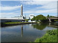
Photos of N18 3AW


Area Information
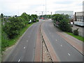
Living in N18 3AW means inhabiting a compact residential cluster in north London, where 1,744 residents are packed into 1.35 km² at a density of 1,293 people per square kilometre. This area is defined by its flat-dominated housing stock and a community skewed toward adults aged 30–64, with a median age of 47. The postcode’s proximity to major transport hubs like Angel Road Railway Station and Turnpike Lane Metro Station ensures easy access to London’s broader network. While broadband connectivity is near flawless at 99/100, mobile coverage scores 85/100, which is good but not exceptional. The area’s small size means daily life is tightly woven around nearby amenities, from retail outlets like Costco Chingford to public transport nodes. However, the high crime risk score of 14/100—well above average—casts a shadow over its otherwise practical layout. For buyers, N18 3AW offers a snapshot of urban living: dense, convenient, but with challenges that demand careful consideration.
- Area Type
- Postcode
- Area Size
- Not available
- Population
- 1744
- Population Density
- 1293 people/km²
N18 3AW’s property market is dominated by flats, with only 24% of homes owned by residents. This suggests a rental market where landlords hold the majority of properties, and owner-occupation is relatively rare. The small postcode area likely contains limited housing stock, meaning buyers must consider nearby zones for options. Flats in this area may be more suited to tenants than investors seeking long-term capital growth. The compact nature of the postcode—covering just 1.35 km²—means property choices are constrained, and competition for available units could be fierce. For those seeking a primary residence, the high crime risk score of 14/100 may raise concerns about security, though this does not directly impact property values. Buyers should weigh the practicality of proximity to transport against potential safety risks.
House Prices in N18 3AW
No properties found in this postcode.
Energy Efficiency in N18 3AW
Daily life in N18 3AW is shaped by its proximity to retail and transport hubs. The area’s five rail stations, including Angel Road and Meridian Water, and five metro stops like Turnpike Lane offer frequent service to London’s wider network. Retail options include Costco Chingford, Aldi Unit 2 Cork Tree Way, and Tesco Lea, providing essentials within walking distance. The Whipps Cross Bus Interchange, though limited to one route, connects to broader services. However, the area lacks parks or leisure facilities, and its small size means amenities are concentrated in nearby zones. The convenience of shops and transport is offset by the absence of green spaces, which may affect quality of life for those prioritising outdoor recreation. For residents, the lifestyle is practical but lacks the diversity of larger neighbourhoods, with daily routines revolving around commuting and retail.
Amenities
Schools
| Rank | School | Type | Entry gender | Ages |
|---|
Explore more schools in this area
Go to Schools tabDemographics
The community in N18 3AW is predominantly adults aged 30–64, with a median age of 47. Only 24% of residents own their homes, suggesting a rental-heavy market, and flats are the most common accommodation type. The area’s demographic profile reflects a mature population, which may influence local services and social dynamics. The predominant ethnic group is Black residents, though specific proportions are not quantified. With 1,744 people in a small area, the population density of 1,293 per km² means proximity to neighbours is inevitable. This density, combined with a high proportion of renters, may shape the area’s character—more transient than other parts of London. Deprivation data is not provided, but the low home ownership rate could indicate economic pressures, though this remains speculative without further evidence.
Household Size
Accommodation Type
Tenure
Ethnic Group
Religion
Household Composition
Age
Household Deprivation
NS-SEC
Explore more demographic insights in this area
Go to Demographics tabPlanning
Planning Constraints
- Flood RiskPremium
- Ramsar Wetland SitesPremium
- Area of Outstanding Natural BeautyPremium
- Protected Nature ReservePremium
- Protected WoodlandPremium