Area Overview for N18 2YA
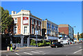
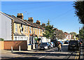
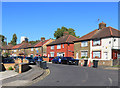
Photos of N18 2YA


Area Information
Living in N18 2YA means inhabiting a compact residential cluster in north London, where the population of 2,063 residents creates a tightly knit community. This postcode is characterised by its proximity to multiple schools, transport hubs, and retail outlets, making it practical for daily life. The area’s small size means residents are likely to know their neighbours, though the demographic mix suggests a diverse population. With a median age of 22, but the most common age range being 30–64, it reflects a balance between younger professionals and established families. The presence of three primary schools—Raynham Infant, Junior, and Primary—alongside an independent North London Muslim School indicates a focus on education. Daily life here is shaped by the availability of nearby shops, multiple rail and metro stations, and digital connectivity that supports remote work. However, the area’s small footprint means it is best suited for those prioritising convenience over expansive space.
- Area Type
- Postcode
- Area Size
- Not available
- Population
- 2063
- Population Density
- 13836 people/km²
The property market in N18 2YA is dominated by flats, with home ownership at 26%, highlighting its role as a rental-focused area. This low ownership rate suggests that the housing stock is largely occupied by tenants, possibly due to the area’s compact size and limited availability of larger properties. The prevalence of flats may appeal to those seeking affordable, manageable living spaces, though it also means the market is less likely to cater to families requiring more space. Buyers considering this area should note that the small postcode size means the immediate surroundings offer limited property diversity. The rental market may be competitive, with demand driven by nearby transport links and schools. For those seeking owner-occupation, the low home ownership percentage indicates a niche opportunity, but potential buyers should assess whether the area’s characteristics align with their long-term needs.
House Prices in N18 2YA
No properties found in this postcode.
Energy Efficiency in N18 2YA
Residents of N18 2YA enjoy access to a range of amenities, including retail outlets like Lidl Upper, Tesco Edmonton, and Spar, which provide everyday shopping convenience. The area’s proximity to multiple rail and metro stations means public transport is a viable option for commuting, while the Whipps Cross Bus Interchange offers additional routes. Though no parks or leisure facilities are explicitly named in the data, the presence of multiple schools and transport hubs suggests a focus on practicality over expansive recreational spaces. The character of daily life here is defined by proximity to essential services, with the compact postcode ensuring that amenities are within walking or short transit distance. For those prioritising convenience over sprawling green spaces, N18 2YA offers a streamlined lifestyle with minimal travel time between key destinations.
Amenities
Schools
Residents of N18 2YA have access to a range of educational institutions, including Raynham Infant School, Raynham Junior School, and Raynham Primary School, all of which are primary-level institutions. The North London Muslim School, an independent school, provides an additional option for families seeking alternative education. While no Ofsted ratings are provided, the presence of multiple primary schools within the area suggests a strong focus on early education. However, the absence of secondary schools in the data implies that families may need to look beyond N18 2YA for secondary-level education. The variety of school types—state and independent—offers flexibility, but parents should verify the availability of transport links to secondary schools outside the postcode. The concentration of primary schools may be a key draw for families prioritising proximity to schools.
| Rank | School | Type | Entry gender | Ages |
|---|
Explore more schools in this area
Go to Schools tabDemographics
N18 2YA has a median age of 22, though the most common age range among residents is 30–64 years. This suggests a mix of younger individuals and older adults, potentially reflecting a transient population or a community with a high proportion of working-age adults. Home ownership here is low, with only 26% of residents owning their homes, indicating that the area is predominantly a rental market. The accommodation type is primarily flats, which aligns with the compact nature of the postcode. The predominant ethnic group is Black Total, though no specific deprivation data is provided. The low home ownership rate and flat-dominated housing stock suggest a demographic that may prioritise affordability over long-term investment. For buyers, this implies a market where properties are often occupied by renters rather than owner-occupiers.
Household Size
Accommodation Type
Tenure
Ethnic Group
Religion
Household Composition
Age
Household Deprivation
NS-SEC
Explore more demographic insights in this area
Go to Demographics tabPlanning
Planning Constraints
- Flood RiskPremium
- Ramsar Wetland SitesPremium
- Area of Outstanding Natural BeautyPremium
- Protected Nature ReservePremium
- Protected WoodlandPremium