Area Overview for N18 2RF
Photos of N18 2RF
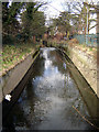
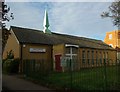
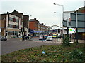
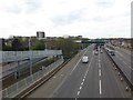
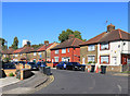
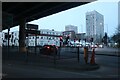
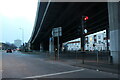
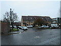
50 photos from this area
Area Information
Key information about the N18 2RF including its size, population, and administrative classification.
- Area Type
- Postcode
- Area Size
- 4833 m²
- Population
- 2234
- Population Density
- 15969 people/km²
House Prices in N18 2RF
19
Properties
£215,659
Average Sold Price
£68,000
Lowest Price
£454,200
Highest Price
Showing 19 properties
| Address | Type | Beds | Baths | Last Sale Price | Last Sale Date | |
|---|---|---|---|---|---|---|
| 5 Hester Road, Edmonton, N18 2RF | Terraced | 3 | 2 | £454,200 | Nov 2023 | |
| 7 Hester Road, Edmonton, N18 2RF | house | - | - | £207,000 | Jan 2023 | |
| 13 Hester Road, Edmonton, N18 2RF | Terraced | 3 | 1 | £359,995 | Oct 2019 | |
| 31 Hester Road, Edmonton, N18 2RF | Terraced | 3 | 1 | £350,000 | Oct 2018 | |
| 11 Hester Road, Edmonton, N18 2RF | Terraced | 4 | 1 | £417,500 | Jun 2017 | |
| 29 Hester Road, Edmonton, N18 2RF | house | 3 | - | £220,000 | Jun 2012 | |
| 23 Hester Road, Edmonton, N18 2RF | Terraced | - | - | £208,000 | May 2011 | |
| 33 Hester Road, Edmonton, N18 2RF | house | - | - | £230,000 | Dec 2006 | |
| 17 Hester Road, Edmonton, N18 2RF | house | - | - | £195,000 | Nov 2003 | |
| 27 Hester Road, Edmonton, N18 2RF | house | - | - | £128,000 | Aug 2001 |
Page 1 of 2
Energy Efficiency in N18 2RF
Amenities
Schools
| Rank | School | Type | Entry gender | Ages |
|---|
Explore more schools in this area
Go to Schools tabDemographics
Household Size
Family (3-5 people)
most common
Accommodation Type
Houses
most common
Tenure
40
majority
Ethnic Group
black_total
most common
Religion
N/A
most common
Household Composition
N/A
most common
Age
47
median
Adults (30-64 years)
most common
Household Deprivation
N/A
with no deprivation
NS-SEC
20
in Lower managerial occupations
Explore more demographic insights in this area
Go to Demographics tabPlanning
Planning Constraints
- Flood RiskPremium
- Ramsar Wetland SitesPremium
- Area of Outstanding Natural BeautyPremium
- Protected Nature ReservePremium
- Protected WoodlandPremium