Area Overview for N18 2NP
Photos of N18 2NP
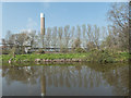
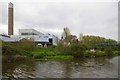
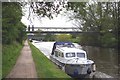
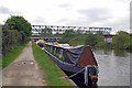
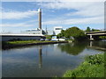
84 photos from this area
Area Information
Key information about the N18 2NP including its size, population, and administrative classification.
- Area Type
- Postcode
- Area Size
- 5892 m²
- Population
- 1744
- Population Density
- 1293 people/km²
House Prices in N18 2NP
41
Properties
£243,385
Average Sold Price
£63,000
Lowest Price
£495,000
Highest Price
Showing 41 properties
| Address | Type | Beds | Baths | Last Sale Price | Last Sale Date | |
|---|---|---|---|---|---|---|
| 210 Montagu Road, Edmonton, N18 2NP | Terraced | 3 | 1 | £328,208 | Mar 2025 | |
| 168 Montagu Road, Edmonton, N18 2NP | Terraced | 3 | 1 | £407,500 | Feb 2025 | |
| 160 Montagu Road, Edmonton, N18 2NP | Terraced | 3 | 1 | £400,000 | Nov 2024 | |
| 172 Montagu Road, Edmonton, N18 2NP | Terraced | 4 | - | £377,000 | Jul 2024 | |
| 178 Montagu Road, Edmonton, N18 2NP | house | - | - | £360,000 | Sep 2021 | |
| 196 Montagu Road, Edmonton, N18 2NP | Terraced | 2 | 1 | £325,000 | Nov 2020 | |
| 152 Montagu Road, Edmonton, N18 2NP | Flat | - | - | £250,000 | Oct 2020 | |
| 184 Montagu Road, Edmonton, N18 2NP | Terraced | 4 | 4 | £495,000 | Dec 2018 | |
| 170 Montagu Road, Edmonton, N18 2NP | Terraced | 4 | 2 | £360,000 | Nov 2015 | |
| 158 Montagu Road, Edmonton, N18 2NP | Terraced | 4 | 1 | £230,000 | Nov 2013 |
Page 1 of 5
Energy Efficiency in N18 2NP
Amenities
Schools
| Rank | School | Type | Entry gender | Ages |
|---|
Explore more schools in this area
Go to Schools tabDemographics
Household Size
Family (3-5 people)
most common
Accommodation Type
Flats
most common
Tenure
24
majority
Ethnic Group
black_total
most common
Religion
N/A
most common
Household Composition
N/A
most common
Age
47
median
Adults (30-64 years)
most common
Household Deprivation
N/A
with no deprivation
NS-SEC
15
in Lower managerial occupations
Explore more demographic insights in this area
Go to Demographics tabPlanning
Planning Constraints
- Flood RiskPremium
- Ramsar Wetland SitesPremium
- Area of Outstanding Natural BeautyPremium
- Protected Nature ReservePremium
- Protected WoodlandPremium