Area Overview for N18 2JS
Photos of N18 2JS
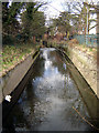

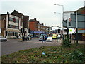
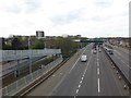
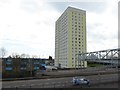
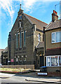
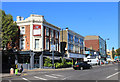
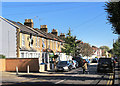
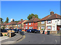
50 photos from this area
Area Information
Key information about the N18 2JS including its size, population, and administrative classification.
- Area Type
- Postcode
- Area Size
- 1835 m²
- Population
- 2234
- Population Density
- 15969 people/km²
House Prices in N18 2JS
11
Properties
£287,600
Average Sold Price
£197,000
Lowest Price
£380,000
Highest Price
Showing 11 properties
| Address | Type | Beds | Baths | Last Sale Price | Last Sale Date | |
|---|---|---|---|---|---|---|
| 78 Woolmer Road, Edmonton, N18 2JS | Terraced | 3 | 1 | £380,000 | Apr 2021 | |
| 74 Woolmer Road, Edmonton, N18 2JS | Terraced | 2 | 1 | £345,000 | Jan 2018 | |
| 82 Woolmer Road, Edmonton, N18 2JS | Terraced | 6 | 4 | £275,000 | Nov 2015 | |
| 76 Woolmer Road, Edmonton, N18 2JS | Terraced | 1 | 1 | £197,000 | Feb 2010 | |
| 84 Woolmer Road, Edmonton, N18 2JS | Terraced | 2 | - | £241,000 | Dec 2005 | |
| 70 Woolmer Road, Edmonton, N18 2JS | Semi-detached | - | - | - | - | |
| 72 Woolmer Road, Edmonton, N18 2JS | house | - | - | - | - | |
| 66 Woolmer Road, Edmonton, N18 2JS | house | - | - | - | - | |
| 68 Woolmer Road, Edmonton, N18 2JS | house | - | - | - | - | |
| Sports Ground, Woolmer Road, Edmonton, N18 2JS | Leisure | - | - | - | - |
Page 1 of 2
Energy Efficiency in N18 2JS
Amenities
Schools
| Rank | School | Type | Entry gender | Ages |
|---|
Explore more schools in this area
Go to Schools tabDemographics
Household Size
Family (3-5 people)
most common
Accommodation Type
Houses
most common
Tenure
40
majority
Ethnic Group
black_total
most common
Religion
N/A
most common
Household Composition
N/A
most common
Age
47
median
Adults (30-64 years)
most common
Household Deprivation
N/A
with no deprivation
NS-SEC
20
in Lower managerial occupations
Explore more demographic insights in this area
Go to Demographics tabPlanning
Planning Constraints
- Flood RiskPremium
- Ramsar Wetland SitesPremium
- Area of Outstanding Natural BeautyPremium
- Protected Nature ReservePremium
- Protected WoodlandPremium