Area Overview for N18 2JE
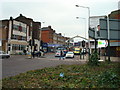
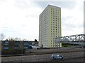
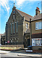
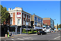
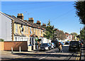
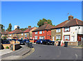
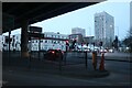
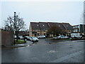
Photos of N18 2JE


Area Information
Living in N18 2JE means being part of a small, tightly knit residential cluster in north London. With a population of 2063, the area is compact but offers a range of amenities within reach. The community is diverse, with the Black population forming the largest ethnic group, and residents predominantly aged between 30 and 64, suggesting a mix of families and professionals. Daily life here is shaped by proximity to transport hubs, including multiple rail, metro, and bus services, making commuting straightforward. The area’s broadband connectivity is excellent, with a score of 96, supporting remote work and digital needs. While the crime risk is high, with a score of 1/100, the flood risk is low, and there are no environmental constraints like protected woodlands or AONB areas. N18 2JE is a practical choice for those prioritising accessibility to London’s transport network and retail options, though safety considerations should be weighed carefully.
- Area Type
- Postcode
- Area Size
- Not available
- Population
- 2063
- Population Density
- 13836 people/km²
The property market in N18 2JE is characterised by a low rate of home ownership, with only 26% of residents owning their homes. This suggests a rental market, where flats dominate as the primary housing type. The small size of the area means housing stock is limited, and the concentration of flats may indicate a focus on high-density living. For buyers, this could present challenges, as owner-occupied properties are scarce. The market may appeal to investors or those seeking short-term rentals, but first-time buyers may find competition for available flats. The lack of data on property prices or development plans means the market’s trajectory remains unclear, though proximity to transport links could sustain demand.
House Prices in N18 2JE
No properties found in this postcode.
Energy Efficiency in N18 2JE
Daily life in N18 2JE is shaped by its proximity to retail and transport hubs. Nearby shops include Lidl Upper, Tesco Edmonton, and Spar, offering essentials within walking distance. The area’s transport links connect residents to larger retail and leisure zones, such as those near Bounds Green and Angel Road. While no parks or green spaces are listed, the presence of multiple rail, metro, and bus services ensures easy access to recreational areas in surrounding boroughs. The mix of retail and transport options contributes to a practical lifestyle, ideal for those prioritising convenience over extensive leisure facilities. The area’s compact size means amenities are concentrated, but residents may need to travel further for specialist services or larger shopping centres.
Amenities
Schools
N18 2JE is served by a range of schools, including Raynham Primary, Raynham Junior, and Raynham Infant Schools, which cater to younger children. The North London Muslim School, an independent institution, offers an alternative for families seeking specific educational approaches. The presence of three primary schools within the area provides multiple options for parents, though no Ofsted ratings are listed. The Tuition Service, categorised as “other,” may offer supplementary education or specialist courses. The diversity of school types reflects the community’s needs, from state-funded primary education to independent institutions. However, the absence of secondary schools in the data means families may need to look beyond N18 2JE for older children’s schooling.
| Rank | School | Type | Entry gender | Ages |
|---|
Explore more schools in this area
Go to Schools tabDemographics
The community in N18 2JE has a median age of 22, but the most common age group is adults aged 30–64, indicating a balance between younger residents and families. Home ownership is low, with only 26% of households owning their properties, suggesting a rental-dominated market. Flats are the primary accommodation type, reflecting the area’s density. The Black population is the largest ethnic group, contributing to the area’s cultural diversity. While no specific deprivation data is provided, the low home ownership rate may imply a reliance on rental income or shared living arrangements. The age profile suggests a stable population with a focus on working-age adults, though the younger median age hints at a student or younger professional presence.
Household Size
Accommodation Type
Tenure
Ethnic Group
Religion
Household Composition
Age
Household Deprivation
NS-SEC
Explore more demographic insights in this area
Go to Demographics tabPlanning
Planning Constraints
- Flood RiskPremium
- Ramsar Wetland SitesPremium
- Area of Outstanding Natural BeautyPremium
- Protected Nature ReservePremium
- Protected WoodlandPremium