Area Overview for N18 2BP
Photos of N18 2BP
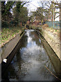
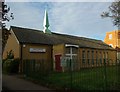
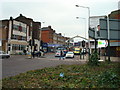
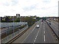
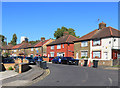
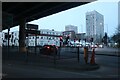
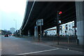
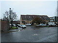
50 photos from this area
Area Information
Key information about the N18 2BP including its size, population, and administrative classification.
- Area Type
- Postcode
- Area Size
- 3965 m²
- Population
- 2234
- Population Density
- 15969 people/km²
House Prices in N18 2BP
26
Properties
£207,496
Average Sold Price
£70,000
Lowest Price
£360,000
Highest Price
Showing 26 properties
| Address | Type | Beds | Baths | Last Sale Price | Last Sale Date | |
|---|---|---|---|---|---|---|
| 95 Raynham Avenue, Edmonton, N18 2BP | house | 2 | 1 | £360,000 | Apr 2018 | |
| 87 Raynham Avenue, Edmonton, N18 2BP | Terraced | 2 | 1 | £355,000 | Dec 2017 | |
| 103B Raynham Avenue, Edmonton, N18 2BP | Flat | 2 | 1 | £200,000 | May 2016 | |
| 89 Raynham Avenue, Edmonton, N18 2BP | Terraced | 2 | - | £285,000 | Apr 2015 | |
| 59 Raynham Avenue, Edmonton, N18 2BP | Terraced | 2 | 1 | £189,000 | Dec 2006 | |
| 69 Raynham Avenue, Edmonton, N18 2BP | house | - | - | £183,000 | Feb 2006 | |
| 101 Raynham Avenue, Edmonton, N18 2BP | Terraced | 4 | 2 | £196,500 | Dec 2004 | |
| 65 Raynham Avenue, Edmonton, N18 2BP | Terraced | - | - | £171,000 | Nov 2003 | |
| 61 Raynham Avenue, Edmonton, N18 2BP | house | - | - | £167,000 | Mar 2003 | |
| 63 Raynham Avenue, Edmonton, N18 2BP | Terraced | - | - | £163,500 | Nov 2002 |
Page 1 of 3
Energy Efficiency in N18 2BP
Amenities
Schools
| Rank | School | Type | Entry gender | Ages |
|---|
Explore more schools in this area
Go to Schools tabDemographics
Household Size
Family (3-5 people)
most common
Accommodation Type
Houses
most common
Tenure
40
majority
Ethnic Group
black_total
most common
Religion
N/A
most common
Household Composition
N/A
most common
Age
47
median
Adults (30-64 years)
most common
Household Deprivation
N/A
with no deprivation
NS-SEC
20
in Lower managerial occupations
Explore more demographic insights in this area
Go to Demographics tabPlanning
Planning Constraints
- Flood RiskPremium
- Ramsar Wetland SitesPremium
- Area of Outstanding Natural BeautyPremium
- Protected Nature ReservePremium
- Protected WoodlandPremium