Area Overview for N17 9RQ
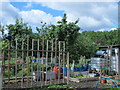
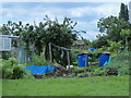
Photos of N17 9RQ


Area Information
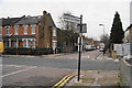
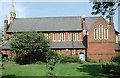
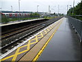
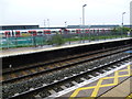
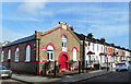
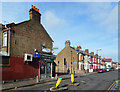
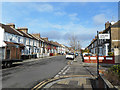
N17 9RQ is a small, tightly knit residential postcode in England, home to 1,809 people. It is a quiet, low-density area characterised by houses rather than flats, reflecting a community that values traditional living. The median age of 47 suggests a mature population, with the majority of residents aged 30–64. This makes it a stable, family-oriented area where many have established long-term roots. Daily life here is shaped by proximity to transport hubs, including Bruce Grove Station and Turnpike Lane, which provide easy access to London’s broader network. The area’s compact size means amenities are within practical reach, from local shops to ferry services. While it lacks the vibrancy of larger urban centres, its simplicity and safety make it appealing to those seeking a balanced, low-stress lifestyle. The absence of environmental constraints or planning restrictions adds to its practicality, ensuring residents can enjoy a straightforward, predictable way of life without regulatory hurdles.
- Area Type
- Postcode
- Area Size
- Not available
- Population
- 1809
- Population Density
- 17229 people/km²
The property market in N17 9RQ is defined by a 43% home ownership rate, suggesting that less than half of properties are owner-occupied, with the remainder likely rented. The area’s accommodation is predominantly houses, not flats, which is uncommon in more densely populated zones. This indicates a housing stock suited to families or individuals seeking space and privacy. However, the small size of the postcode means the available stock is limited, and buyers may need to look beyond the immediate area for options. The mix of ownership and rental properties implies a moderate demand for housing, with no clear indication of rapid price growth. For buyers, this means a focus on existing homes rather than new developments, with potential for long-term stability in a low-risk environment.
House Prices in N17 9RQ
No properties found in this postcode.
Energy Efficiency in N17 9RQ
Living in N17 9RQ offers access to a range of amenities within practical reach. Local retail options include Aldi Bruce, Iceland Tottenham, and Asda Tottenham, providing everyday shopping convenience. The area’s transport hubs, such as Bruce Grove Station and Wood Green Station, connect residents to broader London networks, while ferry services like Camden Lock Waterbus offer alternative routes. Though the area is small, its proximity to multiple transport nodes ensures residents can access cultural and leisure opportunities in nearby districts. The mix of retail, transport, and water-based connectivity creates a functional lifestyle, balancing local convenience with easy access to urban amenities. This makes N17 9RQ suitable for those who value practicality over sprawling commercial centres.
Amenities
Schools
| Rank | School | Type | Entry gender | Ages |
|---|
Explore more schools in this area
Go to Schools tabDemographics
The population of N17 9RQ is predominantly adults aged 30–64, with a median age of 47. This suggests a community of established professionals and families, rather than students or retirees. Home ownership stands at 43%, indicating a mix of owner-occupied properties and rental homes. The area is largely composed of houses, not flats, which aligns with its suburban character. The predominant ethnic group is White, reflecting a homogenous demographic profile. While no data is provided on deprivation levels, the low crime risk and absence of environmental constraints imply a stable, low-pressure environment. This makes N17 9RQ a practical choice for those prioritising security and straightforward living over cultural diversity or rapid change. The demographic makeup ensures a quiet, consistent community rhythm, with little turnover or disruption.
Household Size
Accommodation Type
Tenure
Ethnic Group
Religion
Household Composition
Age
Household Deprivation
NS-SEC
Explore more demographic insights in this area
Go to Demographics tabPlanning
Planning Constraints
- Flood RiskPremium
- Ramsar Wetland SitesPremium
- Area of Outstanding Natural BeautyPremium
- Protected Nature ReservePremium
- Protected WoodlandPremium