Area Overview for N17 9HU
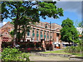
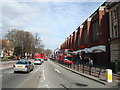
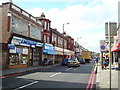
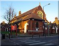
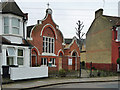
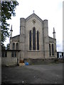
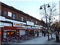
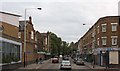
Photos of N17 9HU


Area Information
Living in N17 9HU means inhabiting a compact residential cluster in north London, home to 1,930 residents. This area is defined by its modest size and the presence of flats, reflecting a community that leans towards rental living. The median age of 47 suggests a mature demographic, with adults aged 30–64 forming the largest group. The area’s character is shaped by its proximity to transport hubs, including Bruce Grove Station and Turnpike Lane, which connect residents to broader London. While the postcode lacks natural landscapes or protected sites, it offers practical access to retail, education, and public transport. The diversity of the population, with Black_total as the predominant ethnic group, adds to the area’s distinct cultural fabric. Daily life here balances suburban convenience with urban connectivity, though residents should note the higher crime risk reported in assessments. For those seeking a compact, well-served neighbourhood with a focus on accessibility, N17 9HU provides a blend of practicality and proximity to essential services.
- Area Type
- Postcode
- Area Size
- Not available
- Population
- 1930
- Population Density
- 13861 people/km²
The property market in N17 9HU is characterised by a low home ownership rate of 22%, which points to a rental-dominated market. The accommodation type is predominantly flats, likely reflecting the area’s small size and the prevalence of multi-unit developments. This suggests that buyers seeking owner-occupied properties may find limited options, with the market skewed towards tenants. The compact nature of the postcode means that housing stock is concentrated, and the immediate surroundings may offer similar dynamics. For those considering property investment, the high rental demand could be a factor, though the small scale of the area may limit choice. Buyers should also consider the age of the housing stock, as flats in such areas are often older and may require maintenance. The market is unlikely to cater to large families or those seeking detached homes, making it more suitable for individuals or couples in a rental-focused environment.
House Prices in N17 9HU
Showing 1 properties
| Address | Type | Beds | Baths | Last Sale Price | Last Sale Date | |
|---|---|---|---|---|---|---|
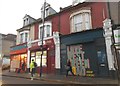
| Dotcom Solicitor, 352-354 High Road, Tottenham, London, N17 9HU | shop | - | - | - | - |
Energy Efficiency in N17 9HU
The lifestyle in N17 9HU is shaped by its access to retail, transport, and leisure options. Nearby shops include Tesco South, Asda Tottenham, and Iceland Tottenham, providing essential grocery and household needs. The area’s proximity to Bruce Grove Station and Turnpike Lane Metro Station connects residents to wider London, while ferry services like Camden Lock Waterbus add a unique dimension to travel. For leisure, the presence of London Zoo Waterbus Stop suggests opportunities for cultural and recreational activities. The variety of transport options, combined with retail hubs, makes daily life convenient. However, the absence of parks or green spaces within the postcode means that residents may need to travel to nearby areas for outdoor activities. Despite this, the area’s practical amenities and connectivity ensure that residents can access both urban and suburban comforts with ease.
Amenities
Schools
The schools near N17 9HU include The Green CofE Primary School and Holy Trinity CofE Primary School, both rated outstanding and good by Ofsted, respectively. These state-funded institutions provide high-quality primary education, while Hyland House School, an independent school with a good rating, offers an alternative for families seeking private education. The presence of North London College of Accountancy, though not a traditional school, adds to the area’s educational diversity. This mix of school types ensures that families have options, whether they prioritise state education, independent schooling, or vocational training. The proximity of these institutions to the area makes it appealing for parents seeking reliable education for their children. However, the absence of secondary schools within the postcode means that students may need to travel to nearby areas for further education, which is a practical consideration for families.
| Rank | School | Type | Entry gender | Ages |
|---|
Explore more schools in this area
Go to Schools tabDemographics
The community in N17 9HU is predominantly composed of adults aged 30–64, with a median age of 47. This suggests a population that is largely settled, with fewer young families or retirees. Home ownership is low, at 22%, indicating that most residents rent their properties. The accommodation type is primarily flats, which aligns with the area’s compact nature and the prevalence of multi-unit housing. The predominant ethnic group is Black_total, reflecting a specific demographic profile that influences the area’s cultural and social dynamics. While no data on deprivation is provided, the low home ownership rate may indicate a reliance on rental markets, which could affect long-term stability for some residents. The age distribution and housing stock suggest a community that is neither young nor elderly, but one that values accessibility over property ownership.
Household Size
Accommodation Type
Tenure
Ethnic Group
Religion
Household Composition
Age
Household Deprivation
NS-SEC
Explore more demographic insights in this area
Go to Demographics tabPlanning
Planning Constraints
- Flood RiskPremium
- Ramsar Wetland SitesPremium
- Area of Outstanding Natural BeautyPremium
- Protected Nature ReservePremium
- Protected WoodlandPremium