Area Overview for N17 9DJ
Photos of N17 9DJ
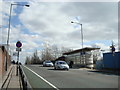
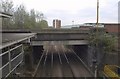

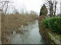
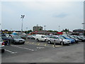


100 photos from this area
Area Information
Key information about the N17 9DJ including its size, population, and administrative classification.
- Area Type
- Postcode
- Area Size
- 3470 m²
- Population
- 2552
- Population Density
- 9034 people/km²
House Prices in N17 9DJ
53
Properties
£170,287
Average Sold Price
£36,500
Lowest Price
£365,000
Highest Price
Showing 53 properties
| Address | Type | Beds | Baths | Last Sale Price | Last Sale Date | |
|---|---|---|---|---|---|---|
| 151 Bream Close, Tottenham, London, N17 9DJ | Flat | 1 | 1 | £285,000 | Oct 2025 | |
| 143 Bream Close, Tottenham, London, N17 9DJ | Flat | 1 | 1 | £185,000 | May 2025 | |
| 166 Bream Close, Tottenham, London, N17 9DJ | Flat | 1 | 1 | £232,000 | Nov 2024 | |
| 150 Bream Close, Tottenham, London, N17 9DJ | Flat | - | 1 | £246,000 | Oct 2024 | |
| 189 Bream Close, Tottenham, London, N17 9DJ | Flat | - | 1 | £207,000 | Sep 2024 | |
| 172 Bream Close, Tottenham, London, N17 9DJ | Flat | - | - | £288,500 | Aug 2024 | |
| 191 Bream Close, Tottenham, London, N17 9DJ | Flat | - | - | £260,000 | Sep 2022 | |
| 181 Bream Close, Tottenham, London, N17 9DJ | Flat | 1 | 1 | £255,000 | Sep 2022 | |
| 157 Bream Close, Tottenham, London, N17 9DJ | Flat | - | - | £295,000 | Feb 2022 | |
| 187 Bream Close, Tottenham, London, N17 9DJ | Flat | - | - | £350,000 | Dec 2021 |
Page 1 of 6
Energy Efficiency in N17 9DJ
Amenities
Schools
| Rank | School | Type | Entry gender | Ages |
|---|
Explore more schools in this area
Go to Schools tabDemographics
Household Size
One person
most common
Accommodation Type
Flats
most common
Tenure
33
majority
Ethnic Group
White
most common
Religion
N/A
most common
Household Composition
N/A
most common
Age
47
median
Adults (30-64 years)
most common
Household Deprivation
N/A
with no deprivation
NS-SEC
35
in Lower managerial occupations
Explore more demographic insights in this area
Go to Demographics tabPlanning
Planning Constraints
- Flood RiskPremium
- Ramsar Wetland SitesPremium
- Area of Outstanding Natural BeautyPremium
- Protected Nature ReservePremium
- Protected WoodlandPremium