Area Overview for N17 8HR
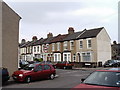
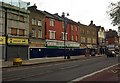
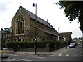
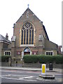
Photos of N17 8HR


Area Information
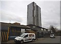
Living in N17 8HR means inhabiting a compact residential cluster in north London, where 2,135 people are spread across just 1,481 square metres. This high population density creates a tightly knit community, though the area’s small size means it is best suited for those prioritising proximity to transport hubs and local amenities over expansive outdoor space. The postcode is defined by its flat-dominated housing stock, reflecting a mix of older and newer residential developments. Nearby schools, including two primary schools with good Ofsted ratings, suggest this area is popular with families. While the median age of 47 indicates a mature population, the presence of sixth-form colleges nearby hints at a broader demographic range. Daily life here is shaped by the proximity to rail, metro, and bus routes, with multiple stations within walking distance. The area’s compact nature means residents are likely to rely on public transport or cycling for longer journeys, though the broadband and mobile scores of 86 and 85 respectively ensure reliable connectivity for remote work or online activities. N17 8HR is not a place for those seeking sprawling estates, but it offers a functional, accessible urban living experience.
- Area Type
- Postcode
- Area Size
- 1481 m²
- Population
- 2135
- Population Density
- 14745 people/km²
The property market in N17 8HR is dominated by flats, with no data indicating the presence of detached or semi-detached homes. The 22% home ownership rate highlights that the majority of residents are renters, suggesting a rental market that may be competitive given the area’s limited housing stock. This small postcode area, covering just 1,481 square metres, means that property availability is constrained, and buyers seeking larger homes may need to look beyond immediate surroundings. The flat-dominated landscape is typical of urban clusters where space is at a premium, and the high population density reinforces this trend. For those considering purchasing, the area’s proximity to transport links and schools could be appealing, but the lack of data on property prices or recent sales means potential buyers must assess the market independently. The small size of N17 8HR also means that any property transaction here is likely to have a noticeable impact on local demand and competition.
House Prices in N17 8HR
No properties found in this postcode.
Energy Efficiency in N17 8HR
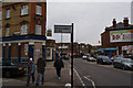
The lifestyle in N17 8HR is shaped by its proximity to retail, healthcare, and transport hubs. Residents have access to Sainsburys Tottenham, Spar, and M&S North Middlesex University Hospital, which provide essential shopping and medical services. The area’s compact nature means that amenities are within walking distance, reducing the need for long commutes. The presence of multiple rail, metro, and bus stops ensures easy access to leisure and employment opportunities beyond the postcode. While there is no mention of parks or recreational spaces in the data, the density of services suggests a focus on convenience over greenery. The availability of both primary and sixth-form education, along with healthcare facilities, supports a family-friendly environment. However, the lack of specific details about local parks or cultural venues means that those prioritising outdoor activities may need to explore nearby areas. Overall, the area offers a functional, accessible lifestyle for those comfortable with urban living.
Amenities
Schools
Residents of N17 8HR have access to a range of educational institutions, including two primary schools with good Ofsted ratings: St Francis de Sales RC Junior School and St Francis de Sales RC Infant School. These schools provide early education for younger children, while the nearby Haringey Sixth Form Centre and Haringey Sixth Form College cater to older students pursuing further education. The presence of both primary and sixth-form institutions within the area suggests a well-rounded educational ecosystem for families. The good Ofsted ratings for the primary schools indicate a commitment to quality teaching and student development, though no specific data on performance metrics or student outcomes is provided. The mix of school types ensures that families can access education at multiple stages of their children’s lives without needing to move far from home. This variety may be particularly beneficial for those balancing work and family commitments in the area.
| Rank | School | Type | Entry gender | Ages |
|---|
Explore more schools in this area
Go to Schools tabDemographics
The community in N17 8HR is predominantly composed of adults aged 30–64, with a median age of 47. This suggests a population focused on established careers and family life, though the 22% home ownership rate indicates that most residents are renters rather than property owners. The accommodation type is almost entirely flats, reflecting the area’s small footprint and density. The predominant ethnic group is Black Total, which shapes the cultural and social fabric of the neighbourhood. While specific deprivation data is not provided, the high population density and reliance on rental housing may influence the area’s economic dynamics. The presence of two primary schools with good Ofsted ratings and sixth-form colleges nearby suggests that families form a significant portion of the population. However, the lack of protected natural areas or green spaces may impact the quality of life for those prioritising outdoor recreation. The community’s character is defined by its compactness, with residents likely to share communal spaces and resources.
Household Size
Accommodation Type
Tenure
Ethnic Group
Religion
Household Composition
Age
Household Deprivation
NS-SEC
Explore more demographic insights in this area
Go to Demographics tabPlanning
Planning Constraints
- Flood RiskPremium
- Ramsar Wetland SitesPremium
- Area of Outstanding Natural BeautyPremium
- Protected Nature ReservePremium
- Protected WoodlandPremium