Area Overview for N17 6UJ
Photos of N17 6UJ

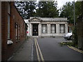
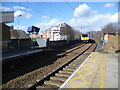
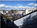
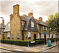
100 photos from this area
Area Information
Key information about the N17 6UJ including its size, population, and administrative classification.
- Area Type
- Postcode
- Area Size
- 5593 m²
- Population
- 2292
- Population Density
- 11706 people/km²
House Prices in N17 6UJ
45
Properties
£287,733
Average Sold Price
£52,000
Lowest Price
£694,000
Highest Price
Showing 45 properties
| Address | Type | Beds | Baths | Last Sale Price | Last Sale Date | |
|---|---|---|---|---|---|---|
| 91 Sperling Road, Tottenham, London, N17 6UJ | Terraced | 5 | 2 | £694,000 | Oct 2024 | |
| 63 Sperling Road, Tottenham, London, N17 6UJ | Terraced | 3 | 1 | £575,000 | May 2024 | |
| 65 Sperling Road, Tottenham, London, N17 6UJ | Retail | 3 | 1 | £630,000 | Jun 2022 | |
| 71 Sperling Road, Tottenham, London, N17 6UJ | Terraced | 3 | - | £630,000 | Jun 2021 | |
| 73 Sperling Road, Tottenham, London, N17 6UJ | house | 3 | 2 | £479,000 | Jun 2017 | |
| 119 Sperling Road, Tottenham, London, N17 6UJ | Terraced | 3 | 1 | £340,000 | Mar 2014 | |
| 83 Sperling Road, Tottenham, London, N17 6UJ | Terraced | 3 | 1 | £306,000 | Sep 2013 | |
| 55 Sperling Road, Tottenham, London, N17 6UJ | Terraced | 5 | 2 | £258,000 | Jun 2013 | |
| 103 Sperling Road, Tottenham, London, N17 6UJ | house | - | - | £228,500 | Aug 2012 | |
| 111 Sperling Road, Tottenham, London, N17 6UJ | house | 3 | - | £225,000 | May 2011 |
Page 1 of 5
Energy Efficiency in N17 6UJ
Amenities
Schools
| Rank | School | Type | Entry gender | Ages |
|---|
Explore more schools in this area
Go to Schools tabDemographics
Household Size
Family (3-5 people)
most common
Accommodation Type
Flats
most common
Tenure
23
majority
Ethnic Group
White
most common
Religion
N/A
most common
Household Composition
N/A
most common
Age
47
median
Adults (30-64 years)
most common
Household Deprivation
N/A
with no deprivation
NS-SEC
24
in Lower managerial occupations
Explore more demographic insights in this area
Go to Demographics tabPlanning
Planning Constraints
- Flood RiskPremium
- Ramsar Wetland SitesPremium
- Area of Outstanding Natural BeautyPremium
- Protected Nature ReservePremium
- Protected WoodlandPremium