Area Overview for N17 6RU
Photos of N17 6RU
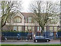
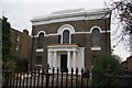
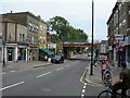
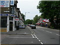
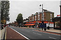
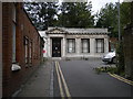
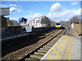
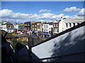
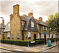
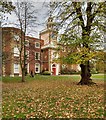
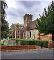
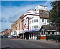
100 photos from this area
Area Information
Key information about the N17 6RU including its size, population, and administrative classification.
- Area Type
- Postcode
- Area Size
- 5444 m²
- Population
- 1927
- Population Density
- 14554 people/km²
House Prices in N17 6RU
37
Properties
£266,357
Average Sold Price
£55,000
Lowest Price
£570,000
Highest Price
Showing 37 properties
| Address | Type | Beds | Baths | Last Sale Price | Last Sale Date | |
|---|---|---|---|---|---|---|
| 41 Lordship Lane, Tottenham, London, N17 6RU | Terraced | 3 | 2 | £570,000 | Apr 2024 | |
| 57 Lordship Lane, Tottenham, London, N17 6RU | house | - | - | £425,000 | Jul 2022 | |
| 47 Lordship Lane, Tottenham, London, N17 6RU | Terraced | 4 | 2 | £392,000 | Dec 2014 | |
| 43 Lordship Lane, Tottenham, London, N17 6RU | house | - | - | £190,000 | Jul 2010 | |
| 51 Lordship Lane, Tottenham, London, N17 6RU | Terraced | - | - | £165,000 | Oct 2001 | |
| 45 Lordship Lane, Tottenham, London, N17 6RU | house | - | - | £55,000 | Oct 1997 | |
| 55 Lordship Lane, Tottenham, London, N17 6RU | Terraced | - | - | £67,500 | May 1995 | |
| Flat A, 27 Lordship Lane, Tottenham, London, N17 6RU | Flat | - | - | - | - | |
| Ground Floor Flat A, 29 Lordship Lane, Tottenham, London, N17 6RU | Flat | - | - | - | - | |
| Second Floor Flat C, 29 Lordship Lane, Tottenham, London, N17 6RU | Flat | - | - | - | - |
Page 1 of 4
Energy Efficiency in N17 6RU
Amenities
Schools
| Rank | School | Type | Entry gender | Ages |
|---|
Explore more schools in this area
Go to Schools tabDemographics
Household Size
One person
most common
Accommodation Type
Flats
most common
Tenure
26
majority
Ethnic Group
White
most common
Religion
N/A
most common
Household Composition
N/A
most common
Age
47
median
Adults (30-64 years)
most common
Household Deprivation
N/A
with no deprivation
NS-SEC
18
in Lower managerial occupations
Explore more demographic insights in this area
Go to Demographics tabPlanning
Planning Constraints
- Flood RiskPremium
- Ramsar Wetland SitesPremium
- Area of Outstanding Natural BeautyPremium
- Protected Nature ReservePremium
- Protected WoodlandPremium