Area Overview for N17 6LG
Photos of N17 6LG


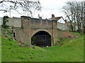
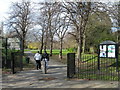

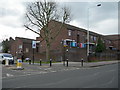
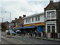
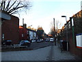
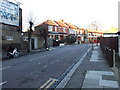
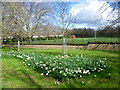
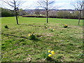
100 photos from this area
Area Information
Key information about the N17 6LG including its size, population, and administrative classification.
- Area Type
- Postcode
- Area Size
- 8419 m²
- Population
- 1661
- Population Density
- 16643 people/km²
House Prices in N17 6LG
41
Properties
£364,685
Average Sold Price
£82,350
Lowest Price
£760,000
Highest Price
Showing 41 properties
| Address | Type | Beds | Baths | Last Sale Price | Last Sale Date | |
|---|---|---|---|---|---|---|
| 15 Downhills Avenue, Tottenham, London, N17 6LG | Terraced | 3 | 1 | £760,000 | May 2024 | |
| 42 Downhills Avenue, Tottenham, London, N17 6LG | house | - | - | £195,000 | Jul 2022 | |
| 22 Downhills Avenue, Tottenham, London, N17 6LG | house | - | - | £666,640 | Oct 2021 | |
| 40 Downhills Avenue, Tottenham, London, N17 6LG | Terraced | 3 | 1 | £590,000 | Mar 2021 | |
| 6 Downhills Avenue, Tottenham, London, N17 6LG | Terraced | 3 | 1 | £620,000 | Dec 2017 | |
| 34 Downhills Avenue, Tottenham, London, N17 6LG | Terraced | 3 | 1 | £585,000 | Sep 2017 | |
| 48 Downhills Avenue, Tottenham, London, N17 6LG | Terraced | 3 | 1 | £590,000 | Dec 2016 | |
| 32 Downhills Avenue, Tottenham, London, N17 6LG | Terraced | 3 | - | £525,000 | Feb 2016 | |
| 1 Downhills Avenue, Tottenham, London, N17 6LG | Terraced | 3 | 1 | £595,000 | Jan 2016 | |
| 8 Downhills Avenue, Tottenham, London, N17 6LG | house | - | - | £425,000 | Sep 2015 |
Page 1 of 5
Energy Efficiency in N17 6LG
Amenities
Schools
| Rank | School | Type | Entry gender | Ages |
|---|
Explore more schools in this area
Go to Schools tabDemographics
Household Size
Family (3-5 people)
most common
Accommodation Type
Houses
most common
Tenure
47
majority
Ethnic Group
White
most common
Religion
N/A
most common
Household Composition
N/A
most common
Age
47
median
Adults (30-64 years)
most common
Household Deprivation
N/A
with no deprivation
NS-SEC
34
in Lower managerial occupations
Explore more demographic insights in this area
Go to Demographics tabPlanning
Planning Constraints
- Flood RiskPremium
- Ramsar Wetland SitesPremium
- Area of Outstanding Natural BeautyPremium
- Protected Nature ReservePremium
- Protected WoodlandPremium