Area Overview for N17 6BH
Photos of N17 6BH
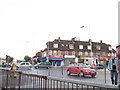


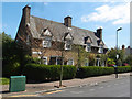


51 photos from this area
Area Information
Key information about the N17 6BH including its size, population, and administrative classification.
- Area Type
- Postcode
- Area Size
- 8514 m²
- Population
- 1800
- Population Density
- 8551 people/km²
House Prices in N17 6BH
9
Properties
£372,800
Average Sold Price
£212,000
Lowest Price
£560,000
Highest Price
Showing 9 properties
| Address | Type | Beds | Baths | Last Sale Price | Last Sale Date | |
|---|---|---|---|---|---|---|
| 67 Walpole Road, Tottenham, London, N17 6BH | house | - | - | £500,000 | Oct 2021 | |
| 65 Walpole Road, Tottenham, London, N17 6BH | house | - | - | £560,000 | Jun 2021 | |
| 73 Walpole Road, Tottenham, London, N17 6BH | house | 3 | - | £355,000 | Sep 2012 | |
| 71 Walpole Road, Tottenham, London, N17 6BH | Terraced | 3 | 2 | £237,000 | Feb 2004 | |
| 63 Walpole Road, Tottenham, London, N17 6BH | Semi-detached | 4 | 1 | £212,000 | Jun 2002 | |
| 61 Walpole Road, Tottenham, London, N17 6BH | Semi-detached | 3 | 1 | - | - | |
| 69 Walpole Road, Tottenham, London, N17 6BH | house | - | - | - | - | |
| St Benet Fink Vicarage, Walpole Road, Tottenham, London, N17 6BH | house | - | - | - | - | |
| Church Hall, Church Of St Benet Fink, Walpole Road, Tottenham, London, N17 6BH | community_day_centre | - | - | - | - |
Energy Efficiency in N17 6BH
Amenities
Schools
| Rank | School | Type | Entry gender | Ages |
|---|
Explore more schools in this area
Go to Schools tabDemographics
Household Size
Family (3-5 people)
most common
Accommodation Type
Houses
most common
Tenure
45
majority
Ethnic Group
White
most common
Religion
N/A
most common
Household Composition
N/A
most common
Age
47
median
Adults (30-64 years)
most common
Household Deprivation
N/A
with no deprivation
NS-SEC
34
in Lower managerial occupations
Explore more demographic insights in this area
Go to Demographics tabPlanning
Planning Constraints
- Flood RiskPremium
- Ramsar Wetland SitesPremium
- Area of Outstanding Natural BeautyPremium
- Protected Nature ReservePremium
- Protected WoodlandPremium