Area Overview for N17 0ZH
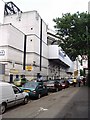
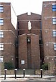
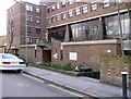
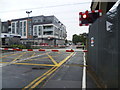
Photos of N17 0ZH


Area Information
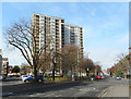
Living in N17 0ZH means being part of a small, tightly knit residential cluster in north London, with a population of just 1,864. This area is characterised by its compact size and proximity to key transport links, making it a practical choice for those seeking a balance between urban convenience and residential tranquillity. The community here is predominantly adults aged 30–64, reflecting a mature demographic that may prioritise stability and established amenities. While the area lacks large-scale developments, it offers access to essential services and schools, which are critical for families. The presence of multiple rail and metro stations within reach ensures easy access to nearby hubs like Tottenham and Wood Green. However, the small population and limited housing stock mean this is not a high-density area, and daily life tends to revolve around local amenities and community networks. For buyers, N17 0ZH presents a niche opportunity to own property in a low-flood-risk zone, though the high crime risk is a notable consideration. The area’s compact nature means that proximity to shops, schools, and transport is a key feature for residents.
- Area Type
- Postcode
- Area Size
- Not available
- Population
- 1864
- Population Density
- 10869 people/km²
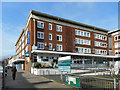
The property market in N17 0ZH is shaped by its small size and the dominance of flats as the primary accommodation type. With only 30% of residents owning their homes, the area leans more towards a rental market than owner-occupation. This dynamic may be influenced by the limited housing stock and the prevalence of purpose-built or converted flats, which are often more suited to tenants than long-term buyers. For prospective buyers, this means that available properties are likely to be fewer and more competitive, with a focus on flats rather than detached or semi-detached homes. The compact nature of the area also means that property values may be influenced more by proximity to transport links and schools than by size or land area. Buyers should consider the high crime risk in the area, which could affect both property desirability and long-term investment potential. Those interested in N17 0ZH may need to prioritise location over property type, given the limited options available.
House Prices in N17 0ZH
No properties found in this postcode.
Energy Efficiency in N17 0ZH
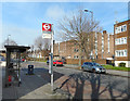
The lifestyle in N17 0ZH is shaped by its proximity to a variety of amenities, including retail, dining, and transport hubs. Residents have access to major supermarkets like Sainsburys Tottenham, Spar, and Tesco Park, ensuring everyday shopping needs are met locally. The area’s transport links also open up access to broader leisure opportunities, with the Camden Lock Waterbus offering a unique way to explore nearby waterways. While the data does not specify parks or recreational facilities, the presence of multiple rail and metro stations suggests easy access to green spaces in surrounding areas. The mix of retail and transport options contributes to a practical, convenience-driven lifestyle, though the area’s small size means that larger-scale leisure facilities may be located further afield. For those prioritising ease of access to shops, transport, and community hubs, N17 0ZH offers a functional base, though the lack of detailed information on local parks or cultural amenities means buyers may need to explore beyond the immediate vicinity for leisure activities.
Amenities
Schools
Residents of N17 0ZH have access to a range of school options, including state and independent institutions. Lea Valley Primary School, a primary school with a Good Ofsted rating, offers a solid foundation for younger children. Northumberland Park Community School, also a primary school, provides another local option. For independent education, Sunrise Primary School is available, though its specific Ofsted rating is not listed. Special educational needs are addressed by Vale School, a specialist institution, while Duke’s Aldridge functions as an academy. This mix of school types allows families to choose between state-funded, independent, and specialist provisions. However, the absence of secondary schools in the immediate vicinity may require families to look further afield for comprehensive education. The presence of multiple primary schools suggests a focus on early education, but buyers should consider the need for secondary school access when evaluating the area’s suitability for growing families.
| Rank | School | Type | Entry gender | Ages |
|---|
Explore more schools in this area
Go to Schools tabDemographics
The population of N17 0ZH is 1,864, with a median age of 47, indicating a mature community where most residents are between 30 and 64 years old. Home ownership is relatively low at 30%, suggesting that a significant proportion of residents are renters, possibly due to the area’s limited housing stock or the prevalence of flats. The accommodation type is predominantly flats, which aligns with the lower home ownership rate and may reflect a mix of purpose-built housing and converted properties. The predominant ethnic group is Black, though specific data on other demographics is not provided. This demographic profile suggests a community that may be more established, with fewer young families compared to other areas. The absence of detailed deprivation data means that while the area’s safety and environmental assessments are clear, the broader socioeconomic context remains less defined. However, the high crime risk score of 15/100 indicates that residents may face challenges related to personal safety, which could influence quality of life and property desirability.
Household Size
Accommodation Type
Tenure
Ethnic Group
Religion
Household Composition
Age
Household Deprivation
NS-SEC
Explore more demographic insights in this area
Go to Demographics tabPlanning
Planning Constraints
- Flood RiskPremium
- Ramsar Wetland SitesPremium
- Area of Outstanding Natural BeautyPremium
- Protected Nature ReservePremium
- Protected WoodlandPremium