Area Overview for N17 0UE
Photos of N17 0UE


Area Information
N17 0UE is a small residential cluster in England, home to 1,717 people. It is a compact area where daily life is shaped by its proximity to transport hubs and retail centres. The community is defined by its demographic profile, with adults aged 30–64 forming the majority. Living here means navigating a mix of urban infrastructure and practical amenities. The area’s appeal lies in its accessibility to rail, metro, and retail options, though its small size means residents are close to both the vibrancy of nearby hubs and the quiet of a tightly knit neighbourhood. With a median age of 47, the area reflects a mature population, often drawn to its established infrastructure and connectivity. While it lacks the sprawling green spaces of larger towns, its strategic location near stations like Northumberland Park and Angel Road Railway Station makes it a practical choice for commuters. The area’s character is defined by its balance of convenience and community, though buyers should consider its limited housing stock and rental-focused market.
- Area Type
- Postcode
- Area Size
- Not available
- Population
- 1717
- Population Density
- 2157 people/km²
The property market in N17 0UE is characterised by a low home ownership rate of 18%, indicating that the majority of properties are rented rather than owner-occupied. The primary accommodation type is flats, which suggests a focus on high-density housing. This dynamic positions the area as a rental market rather than a buyer’s market, with limited opportunities for long-term investment in property. The small size of the postcode area means that housing stock is constrained, and buyers seeking owner-occupied properties may find the selection limited. Flats dominate, often in blocks that serve a transient population. For those considering the area, the rental focus and flat-based housing mean that property values may not appreciate significantly, but the demand for rental units could provide stability. Prospective buyers should also consider the practical implications of a low home ownership rate, which may affect local amenities and community cohesion.
House Prices in N17 0UE
No properties found in this postcode.
Energy Efficiency in N17 0UE
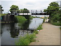
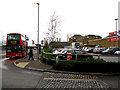
Living in N17 0UE provides access to a range of amenities within practical reach. Retail options include major supermarkets like Tesco Park, Tesco Lea, and Sainsburys Tottenham, ensuring everyday shopping needs are met. Transport is a key feature, with five rail stations, five metro stops, and connections to Northumberland Park and Angel Road Railway Station. The area also includes a bus interchange at Whipps Cross and a ferry service at Camden Lock Waterbus, offering varied travel options. While green spaces are not explicitly listed, the proximity to stations like Wood Green and Manor House suggests nearby parks or recreational areas. The density of transport and retail hubs supports a convenient lifestyle, though the area’s small size means residents may need to travel further for more specialised services. The mix of retail, transport, and connectivity makes N17 0UE a practical choice for those prioritising accessibility over expansive local amenities.
Amenities
Schools
| Rank | School | Type | Entry gender | Ages |
|---|
Explore more schools in this area
Go to Schools tabDemographics
The population of N17 0UE is 1,717, with a median age of 47. The majority of residents are adults aged 30–64, reflecting a mature demographic. Home ownership is low, with only 18% of properties owner-occupied, indicating a rental-dominated market. The primary accommodation type is flats, suggesting a focus on high-density living. The predominant ethnic group is Black, though no further breakdown of diversity is provided. This demographic profile shapes the area’s social fabric, with a focus on stability and established communities. The low home ownership rate may influence the local economy, with a higher reliance on rental income and services. For residents, this means a community where transient populations are common, and shared spaces like retail and transport hubs play a central role in daily life. The age range also suggests a population with established careers and family structures, though the lack of data on household types limits deeper analysis.
Household Size
Accommodation Type
Tenure
Ethnic Group
Religion
Household Composition
Age
Household Deprivation
NS-SEC
Explore more demographic insights in this area
Go to Demographics tabPlanning
Planning Constraints
- Flood RiskPremium
- Ramsar Wetland SitesPremium
- Area of Outstanding Natural BeautyPremium
- Protected Nature ReservePremium
- Protected WoodlandPremium