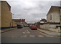
Area Overview for N17 0SE
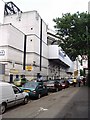
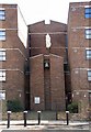
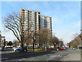
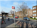
Photos of N17 0SE


Area Information
Living in N17 0SE means being part of a small, tightly knit residential cluster in north London, home to 2,129 people. This postcode is characterised by its compact nature, with homes primarily in the form of houses rather than flats. The area’s demographic profile suggests a mature population, with a median age of 47 and most residents falling within the 30–64 age range. Daily life here is shaped by proximity to transport hubs, including five rail stations such as Meridian Water Station and Angel Road Railway Station, alongside metro stops like Turnpike Lane and Wood Green. Retail options are varied, with Tesco Lea, Spar, and other local shops within practical reach. The presence of Meridian Angel Primary School, rated ‘good’ by Ofsted, adds to the appeal for families. While the area is small, it offers a mix of urban connectivity and suburban convenience, though residents should be mindful of the high crime risk reported in assessments.
- Area Type
- Postcode
- Area Size
- Not available
- Population
- 2129
- Population Density
- 2309 people/km²
The property market in N17 0SE is defined by its small scale and focus on houses. With 42% of homes owned by residents, the area is not heavily reliant on rental demand, though the exact proportion of rental properties is unspecified. The predominance of houses over flats suggests a quieter, more private living environment compared to high-rise developments. Given the postcode’s compact size, the housing stock is limited, which may make the market competitive for buyers. Those seeking larger properties may find opportunities, but the immediate surroundings offer few alternatives. The mix of home ownership and rental units indicates a balance between long-term residents and those in transient situations. For buyers, the challenge lies in the limited inventory, requiring careful consideration of proximity to amenities and transport links.
House Prices in N17 0SE
No properties found in this postcode.
Energy Efficiency in N17 0SE
Life in N17 0SE is shaped by its proximity to a range of amenities. Retail options include Tesco Lea, Tesco Park, and Spar, providing essential shopping and convenience services. The rail network, with stations like Meridian Water and Angel Road, connects residents to wider London, while metro stops such as Turnpike Lane and Wood Green facilitate quick journeys to the city. A single bus interchange at Whipps Cross and a ferry service at Camden Lock Waterbus add to the transport diversity. Though the area is small, its amenities are practical for daily needs, from groceries to public transport. The presence of these facilities supports a lifestyle that balances local convenience with urban accessibility, though the limited number of venues suggests a focus on function over variety.
Amenities
Schools
The primary school nearest to N17 0SE is Meridian Angel Primary School, which serves the local community with a ‘good’ Ofsted rating. This institution is the only named school in the data, suggesting that families in the area rely on it for early education. The absence of secondary schools or other educational institutions within the postcode means parents may need to look beyond N17 0SE for comprehensive schooling. However, the quality of the primary school provides a foundation for young learners. The ‘good’ rating indicates that the school meets or exceeds national standards in teaching and student outcomes, which is a positive factor for families prioritising education.
| Rank | School | Type | Entry gender | Ages |
|---|
Explore more schools in this area
Go to Schools tabDemographics
The community in N17 0SE is predominantly composed of adults aged 30–64, with a median age of 47. Home ownership stands at 42%, indicating a mix of owner-occupied properties and rental units. The accommodation type is largely houses, reflecting a suburban character rather than high-density living. The predominant ethnic group is White, though no further breakdown of diversity is provided. The low deprivation data—while not explicitly stated—suggests that the area’s residents may have access to essential services and amenities. However, the high crime risk score of 2/100 highlights a need for caution, particularly for households with vulnerable members. The demographic profile points to a stable, middle-aged population, likely with established careers and family ties to the area.
Household Size
Accommodation Type
Tenure
Ethnic Group
Religion
Household Composition
Age
Household Deprivation
NS-SEC
Explore more demographic insights in this area
Go to Demographics tabPlanning
Planning Constraints
- Flood RiskPremium
- Ramsar Wetland SitesPremium
- Area of Outstanding Natural BeautyPremium
- Protected Nature ReservePremium
- Protected WoodlandPremium