Area Overview for N17 0PD
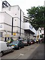
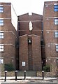
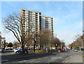
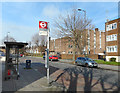
Photos of N17 0PD


Area Information
Living in N17 0PD means being part of a small, tightly knit residential cluster in north London, with a population of 1864. This area is characterised by its proximity to essential services and transport links, making it practical for daily life. The community is predominantly composed of adults aged 30–64, reflecting a mature demographic profile. While the area lacks large-scale amenities, its strategic location near retail hubs, schools, and public transport ensures residents have access to what they need without long commutes. The postcode covers a compact footprint, with a focus on flats as the primary housing type. For those seeking a balance between urban convenience and residential tranquility, N17 0PD offers a functional base, though its small size means the immediate surroundings are key to daily experiences.
- Area Type
- Postcode
- Area Size
- Not available
- Population
- 1864
- Population Density
- 10869 people/km²
The property market in N17 0PD is defined by its limited housing stock, with flats being the dominant accommodation type. Only 30% of residents own their homes, pointing to a market that is largely rental-focused. This suggests that buyers in the area may find fewer opportunities for owner-occupied properties, with the available stock likely concentrated in purpose-built flats. The small size of the postcode means that the immediate surrounding areas are critical for property seekers, as the local market is unlikely to offer a wide range of options. For those considering purchase, the focus would need to shift to nearby zones where more varied housing might be available, though the proximity to transport and amenities could offset the limitations of the local stock.
House Prices in N17 0PD
No properties found in this postcode.
Energy Efficiency in N17 0PD
Residents of N17 0PD benefit from a variety of nearby amenities, including retail outlets such as Sainsburys Tottenham and Tesco Park, which provide essential shopping needs. The area’s transport links, including White Hart Lane Station and Turnpike Lane, facilitate easy access to leisure and employment opportunities. For those seeking recreation, the proximity to parks and open spaces, though not explicitly listed, may be inferred from the absence of environmental constraints like AONB or protected woodlands. The presence of a ferry service, albeit limited to Camden Lock Waterbus, adds a unique dimension to local mobility. Overall, the area offers a practical lifestyle with a focus on accessibility and convenience, though its compact size means the immediate surroundings are vital to daily experiences.
Amenities
Schools
Residents of N17 0PD have access to a range of school options, including state and independent institutions. Lea Valley Primary School, a primary school with a good Ofsted rating, provides a solid foundation for younger children. Northumberland Park Community School, also a primary school, offers a local state alternative, while Sunrise Primary School is an independent option. Vale School caters to special educational needs, and Duke’s Aldridge is an academy. This mix of school types allows families to choose between state, specialist, or independent education, though the availability of independent schools may be limited to specific catchment areas. The presence of both mainstream and specialist provision ensures that most educational needs are met within the area.
| Rank | School | Type | Entry gender | Ages |
|---|
Explore more schools in this area
Go to Schools tabDemographics
The population of N17 0PD is 1864, with a median age of 47. The majority of residents fall within the 30–64 age range, indicating a community of established adults, many of whom may be in their prime working years. Home ownership is relatively low at 30%, suggesting that a significant portion of the population rents. The area is predominantly composed of flats, which aligns with the compact nature of the postcode. The predominant ethnic group is Black_total, reflecting a specific demographic composition. This profile implies a community that is stable but may have limited generational diversity. The low home ownership rate could indicate a reliance on rental properties, which may affect long-term investment potential for buyers.
Household Size
Accommodation Type
Tenure
Ethnic Group
Religion
Household Composition
Age
Household Deprivation
NS-SEC
Explore more demographic insights in this area
Go to Demographics tabPlanning
Planning Constraints
- Flood RiskPremium
- Ramsar Wetland SitesPremium
- Area of Outstanding Natural BeautyPremium
- Protected Nature ReservePremium
- Protected WoodlandPremium