Area Overview for N17 0AE
Photos of N17 0AE

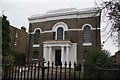
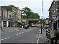
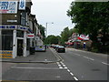
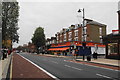
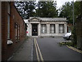
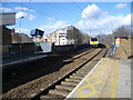
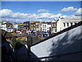
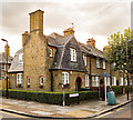
100 photos from this area
Area Information
Key information about the N17 0AE including its size, population, and administrative classification.
- Area Type
- Postcode
- Area Size
- 7924 m²
- Population
- 2246
- Population Density
- 16938 people/km²
House Prices in N17 0AE
53
Properties
£715,000
Average Sold Price
£80,000
Lowest Price
£1,350,000
Highest Price
Showing 53 properties
| Address | Type | Beds | Baths | Last Sale Price | Last Sale Date | |
|---|---|---|---|---|---|---|
| Upper Flat, 704-706 High Road, Tottenham, London, N17 0AE | Flat | - | - | £1,350,000 | Aug 2022 | |
| 698 HIGH ROAD, Tottenham, London, N17 0AE | Terraced | - | - | £80,000 | Jul 1997 | |
| Flat 3, John Cameron Court, 700 High Road, Tottenham, London, N17 0AE | Flat | 1 | 1 | - | - | |
| 682 High Road, Tottenham, London, N17 0AE | Flat | 2 | 1 | - | - | |
| Flat 1, John Cameron Court, 700 High Road, Tottenham, London, N17 0AE | Flat | 3 | 1 | - | - | |
| Ground Floor Offices, 676A High Road, Tottenham, London, N17 0AE | Office | - | - | - | - | |
| 706 High Road, Tottenham, London, N17 0AE | retail_financial | - | - | - | - | |
| 676 High Road, Tottenham, London, N17 0AE | community_day_centre | - | - | - | - | |
| Flat B, 710 High Road, Tottenham, London, N17 0AE | Flat | - | - | - | - | |
| Flat A, 710 High Road, Tottenham, London, N17 0AE | Flat | - | - | - | - |
Page 1 of 6
Energy Efficiency in N17 0AE
Amenities
Schools
| Rank | School | Type | Entry gender | Ages |
|---|
Explore more schools in this area
Go to Schools tabDemographics
Household Size
Family (3-5 people)
most common
Accommodation Type
Flats
most common
Tenure
27
majority
Ethnic Group
black_total
most common
Religion
N/A
most common
Household Composition
N/A
most common
Age
47
median
Adults (30-64 years)
most common
Household Deprivation
N/A
with no deprivation
NS-SEC
21
in Lower managerial occupations
Explore more demographic insights in this area
Go to Demographics tabPlanning
Planning Constraints
- Flood RiskPremium
- Ramsar Wetland SitesPremium
- Area of Outstanding Natural BeautyPremium
- Protected Nature ReservePremium
- Protected WoodlandPremium