Area Overview for N16 8TQ
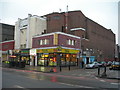
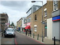
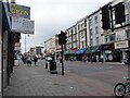
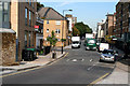
Photos of N16 8TQ


Area Information
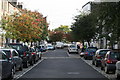
N16 8TQ is a small residential postcode in England, home to 1977 people. It is a compact cluster of properties, likely centred around a mix of flats and terraced housing. The area’s population suggests a tight-knit community, with a median age of 47 and a strong presence of adults aged 30–64. Daily life here is shaped by proximity to transport hubs, retail outlets, and schools. Residents benefit from excellent broadband connectivity, scoring 100 for fixed broadband, which supports remote work and digital lifestyles. The area’s low flood risk and absence of environmental constraints like AONB or protected woodlands make it practical for long-term living. However, the moderate crime risk score of 54 means standard security measures are advisable. N16 8TQ sits at the edge of London’s transport network, with nearby rail, metro, and bus links, making it a viable option for commuters. Its small size means the character of the area is defined by its immediate surroundings, from local shops to community spaces.
- Area Type
- Postcode
- Area Size
- Not available
- Population
- 1977
- Population Density
- 16165 people/km²
The property market in N16 8TQ is characterised by a high concentration of flats, with 48% of homes owner-occupied. This suggests a mix of long-term residents and renters, though the small area size means housing stock is limited. The prevalence of flats may indicate a focus on compact, low-maintenance living, appealing to professionals or couples. With a population of 1977, the area is unlikely to have a large-scale rental market, but its proximity to transport hubs like Canonbury Station and Manor House could make it attractive to commuters. Buyers should consider that the limited housing stock may mean competition for properties, particularly near amenities. The lack of environmental constraints like AONB or protected woodlands also makes it a practical choice for those prioritising convenience over natural landscapes.
House Prices in N16 8TQ
No properties found in this postcode.
Energy Efficiency in N16 8TQ
Living in N16 8TQ offers access to a range of amenities within walking or short transport distance. Retail options include Tesco Matthias, Tesco Stoke Newington, and Co-op Dalston, providing everyday shopping needs. The area’s transport links, such as Canonbury Station and Manor House, connect residents to London’s broader network. For leisure, the nearby Camden Lock Waterbus and Blackfriars Pier offer water-based travel, while bus services like the Green Line Coach Station provide regional connectivity. The presence of multiple rail and metro stations suggests a dynamic, accessible environment. However, the data does not detail parks or green spaces, so residents may need to travel further for outdoor recreation. The mix of retail, transport, and commuter-focused infrastructure creates a practical, convenience-driven lifestyle, though community-specific amenities remain unclear.
Amenities
Schools
The nearest school to N16 8TQ is Grasmere Primary School, which has a ‘good’ Ofsted rating. This primary school serves the area’s younger residents, though no secondary schools are listed in the data. Families requiring secondary education may need to look further afield, as the area’s small size means local options are limited. The presence of a well-rated primary school is a key draw for families, offering a foundation for early education. However, the absence of secondary schools nearby means parents should plan for commuting or consider areas with more comprehensive school networks. Grasmere Primary’s ‘good’ rating suggests it meets national standards, but its capacity to serve the area’s 1977 residents may depend on local planning and expansion efforts.
| Rank | School | Type | Entry gender | Ages |
|---|
Explore more schools in this area
Go to Schools tabDemographics
The population of N16 8TQ is predominantly adults aged 30–64, with a median age of 47. Home ownership here is relatively low at 48%, suggesting a significant proportion of residents rent their homes. The accommodation type is largely flats, reflecting a housing stock suited to smaller households or couples. The predominant ethnic group is White, though no specific data on diversity or deprivation is provided. This age profile indicates a community of established professionals and families, with fewer young children or retirees compared to other areas. The 48% home ownership rate implies a balance between owner-occupied properties and rental units, potentially influenced by the area’s proximity to transport and amenities. The absence of detailed diversity statistics means the full demographic picture remains incomplete, but the data available highlights a mature, stable population.
Household Size
Accommodation Type
Tenure
Ethnic Group
Religion
Household Composition
Age
Household Deprivation
NS-SEC
Explore more demographic insights in this area
Go to Demographics tabPlanning
Planning Constraints
- Flood RiskPremium
- Ramsar Wetland SitesPremium
- Area of Outstanding Natural BeautyPremium
- Protected Nature ReservePremium
- Protected WoodlandPremium