Area Overview for N16 8JU
Photos of N16 8JU
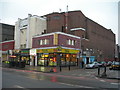
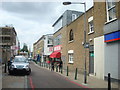
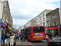
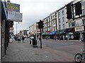
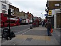
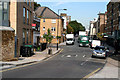
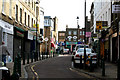
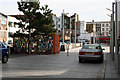
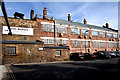
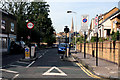
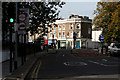
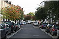
100 photos from this area
Area Information
Key information about the N16 8JU including its size, population, and administrative classification.
- Area Type
- Postcode
- Area Size
- 2944 m²
- Population
- 1940
- Population Density
- 18476 people/km²
House Prices in N16 8JU
20
Properties
£768,300
Average Sold Price
£80,000
Lowest Price
£1,195,000
Highest Price
Showing 20 properties
| Address | Type | Beds | Baths | Last Sale Price | Last Sale Date | |
|---|---|---|---|---|---|---|
| 3 St Jude Street, London, N16 8JU | Terraced | 4 | 2 | £1,188,000 | Oct 2023 | |
| 11 St Jude Street, London, N16 8JU | Terraced | 3 | 2 | £931,000 | Dec 2021 | |
| 5 St Jude Street, London, N16 8JU | Terraced | 3 | 1 | £1,080,000 | Jun 2021 | |
| 19 St Jude Street, London, N16 8JU | house | - | - | £1,195,000 | Aug 2019 | |
| 9 St Jude Street, London, N16 8JU | Terraced | 2 | 2 | £1,135,000 | Mar 2018 | |
| 21 St Jude Street, London, N16 8JU | house | - | - | £1,000,000 | Aug 2017 | |
| 7 St Jude Street, London, N16 8JU | Terraced | 2 | 1 | £442,000 | Dec 2005 | |
| 17 St Jude Street, London, N16 8JU | Terraced | - | - | £80,000 | Mar 2002 | |
| 1 St Jude Street, London, N16 8JU | Terraced | 4 | 1 | £337,000 | Jun 2001 | |
| 15 St Jude Street, London, N16 8JU | house | - | - | £295,000 | Mar 2001 |
Page 1 of 2
Energy Efficiency in N16 8JU
Amenities
Schools
| Rank | School | Type | Entry gender | Ages |
|---|
Explore more schools in this area
Go to Schools tabDemographics
Household Size
Family (3-5 people)
most common
Accommodation Type
Flats
most common
Tenure
14
majority
Ethnic Group
White
most common
Religion
N/A
most common
Household Composition
N/A
most common
Age
47
median
Adults (30-64 years)
most common
Household Deprivation
N/A
with no deprivation
NS-SEC
31
in Lower managerial occupations
Explore more demographic insights in this area
Go to Demographics tabPlanning
Planning Constraints
- Flood RiskPremium
- Ramsar Wetland SitesPremium
- Area of Outstanding Natural BeautyPremium
- Protected Nature ReservePremium
- Protected WoodlandPremium