Area Overview for N16 6YP
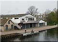
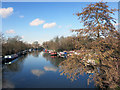
Photos of N16 6YP


Area Information
Living in N16 6YP means being part of a small, tightly knit residential cluster in England, home to 1,830 people. This area is defined by its compact nature, with a focus on practical living rather than sprawling development. The community is characterised by a mix of amenities within easy reach, including retail outlets, transport hubs, and schools. While the population is modest, the area is well-connected to surrounding zones through multiple rail, metro, and bus services. Daily life here balances proximity to urban conveniences with the quietude of a smaller neighbourhood. The presence of primary schools such as Oldhill Community School and St Thomas’s Church of England Primary School suggests a family-oriented environment, though the area’s small size means it is not a major commercial or cultural hub. Residents benefit from excellent broadband connectivity and a low crime risk, which together support a stable, low-stress lifestyle. For those seeking a place with accessible services but without the pressures of a larger city, N16 6YP offers a straightforward, functional living option.
- Area Type
- Postcode
- Area Size
- Not available
- Population
- 1830
- Population Density
- 19345 people/km²
The property market in N16 6YP is dominated by flats, with home ownership at 28%, meaning most properties are rented. This suggests a rental market rather than a buyer-occupied one, which could be due to the area’s small size and limited housing stock. The prevalence of flats indicates a focus on space efficiency, possibly catering to younger professionals or families seeking manageable living arrangements. For buyers, this small area may not offer a wide range of options, but proximity to transport links and amenities could make it appealing for those prioritising convenience over property choice. The low home ownership rate also implies that property values may be influenced by rental demand rather than long-term investment trends. Those considering purchase should note that the market is likely competitive, with limited scope for expansion or development given the area’s compact nature.
House Prices in N16 6YP
No properties found in this postcode.
Energy Efficiency in N16 6YP
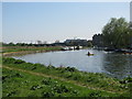
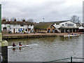
Residents of N16 6YP have access to a range of amenities within walking or short transit distance. Retail options include supermarkets such as Morrisons Stoke, Sainsburys Stamford, and Tesco Hackney, providing everyday shopping convenience. Transport hubs like Stoke Newington Station, Clapton Station, and Whipps Cross Bus Interchange ensure easy access to London’s rail, metro, and bus networks. For leisure, ferry services at Camden Lock Waterbus and Tower Pier offer alternative travel routes. The area’s proximity to multiple stations and interchanges supports a dynamic lifestyle, with opportunities for both local and long-distance travel. While the data does not specify parks or recreational spaces, the presence of diverse transport and retail options suggests a community focused on practicality and connectivity. These amenities collectively contribute to a functional, accessible living environment.
Amenities
Schools
Residents of N16 6YP have access to two primary schools: Oldhill Community School, which holds an Ofsted rating of ‘good’, and St Thomas’s Church of England Primary School. Both institutions serve the local community, offering education for younger children. The presence of two primary schools within proximity suggests that families with young children can find suitable options nearby. However, no secondary schools are listed in the data, meaning students may need to travel to adjacent areas for further education. The ‘good’ rating at Oldhill Community School indicates a school that meets acceptable standards, though specific details on curriculum or facilities are not provided. For families prioritising school quality, the availability of two primary options is a practical advantage, though the absence of secondary schools is a consideration for long-term planning.
| Rank | School | Type | Entry gender | Ages |
|---|
Explore more schools in this area
Go to Schools tabDemographics
The population of N16 6YP has a median age of 22, though the most common age range among residents is adults aged 30–64 years. This suggests a mix of younger and middle-aged individuals, with a relatively small proportion of elderly residents. Home ownership in the area is low, at just 28%, indicating that a significant portion of the housing stock is rented. The predominant accommodation type is flats, which aligns with the area’s compact nature and likely influence of nearby urban planning. The predominant ethnic group is White, though no specific data on diversity or deprivation levels is provided. The age profile and housing data suggest a community that may include professionals working in adjacent areas, students, or those seeking affordable rental options. The low home ownership rate could reflect a transient population or a focus on short-term housing needs.
Household Size
Accommodation Type
Tenure
Ethnic Group
Religion
Household Composition
Age
Household Deprivation
NS-SEC
Explore more demographic insights in this area
Go to Demographics tabPlanning
Planning Constraints
- Flood RiskPremium
- Ramsar Wetland SitesPremium
- Area of Outstanding Natural BeautyPremium
- Protected Nature ReservePremium
- Protected WoodlandPremium