Area Overview for N16 6UG
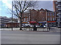
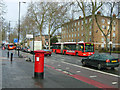
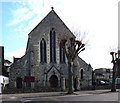
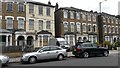
Photos of N16 6UG


Area Information
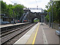
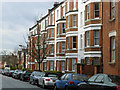
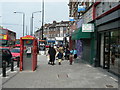
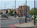
Living in N16 6UG offers a compact, residential experience with a population of 1,699 spread across a small cluster of homes. The area is defined by its proximity to transport hubs, including multiple rail, metro, and bus stops, which connect residents to London’s broader network. Daily life here is shaped by the presence of independent schools, retail outlets, and a mix of local amenities. The community is predominantly composed of adults aged 30–64, suggesting a balance of established professionals and families. With a low crime risk and no environmental constraints like protected woodlands or wetlands, the area is practical for those seeking a functional, low-maintenance lifestyle. The housing stock, largely flats, reflects a rental-focused market, though buyers may find opportunities in this small, well-connected postcode.
- Area Type
- Postcode
- Area Size
- Not available
- Population
- 1699
- Population Density
- 14904 people/km²
The property market in N16 6UG is rental-oriented, with 33% of homes owned by residents and the majority being flats. This suggests a focus on apartments rather than detached or semi-detached housing. The small size of the area means the housing stock is concentrated, potentially limiting options for buyers. For those considering purchase, the market may appeal to investors or those seeking a flat in a well-connected location. The low home ownership rate also indicates that the area is not heavily populated by long-term residents, which could affect the sense of community. Buyers should consider the limited availability of owner-occupied properties when exploring the area.
House Prices in N16 6UG
No properties found in this postcode.
Energy Efficiency in N16 6UG
Daily life in N16 6UG is shaped by its proximity to retail, transport, and leisure options. Nearby shops include Sainsburys Stamford, Morrisons Stoke, and Sainsburys Tottenham Seven, offering convenience for grocery shopping. The area’s rail, metro, and bus networks provide easy access to London’s cultural and commercial hubs, while ferry services to Camden Lock and Tower Pier add flexibility for leisure travel. The combination of retail outlets and transport links ensures a practical, accessible lifestyle, ideal for those prioritising connectivity and convenience over sprawling green spaces.
Amenities
Schools
Near N16 6UG are several independent schools, including Side By Side Nursery, Bnos Zion of Bobov (with a satisfactory Ofsted rating), Bnei Zion Community School (rated inadequate), and Yesodey Hatorah Girls School (rated good). The presence of multiple independent schools suggests a focus on private education, though the ratings vary. Families seeking high-quality schooling may find Yesodey Hatorah Girls School appealing, while Bnei Zion Community School’s inadequate rating could be a concern. The mix of school types and performance highlights the need for prospective parents to visit and assess individual institutions.
| Rank | School | Type | Entry gender | Ages |
|---|
Explore more schools in this area
Go to Schools tabDemographics
The community in N16 6UG is predominantly adults aged 30–64, with a median age of 22, indicating a mix of younger residents and older households. Home ownership is low at 33%, meaning most residents rent their accommodation. The area is characterised by flats, which dominate the housing stock. The predominant ethnic group is White, and the data does not indicate significant diversity beyond this. The low home ownership rate suggests a transient or rental-focused population, which may influence the character of the neighbourhood. For families, the presence of independent schools nearby could be a draw, though the mix of school ratings varies.
Household Size
Accommodation Type
Tenure
Ethnic Group
Religion
Household Composition
Age
Household Deprivation
NS-SEC
Explore more demographic insights in this area
Go to Demographics tabPlanning
Planning Constraints
- Flood RiskPremium
- Ramsar Wetland SitesPremium
- Area of Outstanding Natural BeautyPremium
- Protected Nature ReservePremium
- Protected WoodlandPremium