Area Overview for N16 6SF
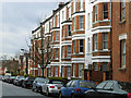
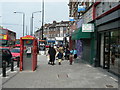
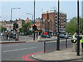
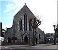
Photos of N16 6SF


Area Information
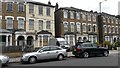
Living in N16 6SF means inhabiting a small, tightly knit residential cluster in north London, where the population of 1,634 reflects a community shaped by proximity to transport hubs and local amenities. The area’s character is defined by its youthful demographic, with a median age of 22 and a significant proportion of children under 14. This suggests a family-oriented environment, though the 21% home ownership rate indicates that most residents are renters, likely drawn by the area’s accessibility. The mix of flats as the primary accommodation type points to a focus on practical, compact living. Despite its small size, N16 6SF is well-connected, with nearby rail, metro, and bus services offering seamless links to central London. Digital connectivity is strong, with broadband and mobile scores of 85, ensuring reliable internet for work or leisure. However, the area’s safety profile is mixed: while flood risk is negligible, crime rates are above average, requiring residents to be mindful of security. For those prioritising convenience and transport links over property ownership, N16 6SF offers a compact, functional base in a dynamic part of the city.
- Area Type
- Postcode
- Area Size
- Not available
- Population
- 1634
- Population Density
- 12866 people/km²
The property market in N16 6SF is dominated by rental flats, with only 21% of residents owning their homes. This suggests a market skewed towards tenants rather than long-term buyers, likely due to the area’s function as a commuter zone with limited space for larger properties. The prevalence of flats indicates a focus on affordability and practicality, catering to those prioritising proximity to transport over home ownership. For buyers, the small postcode area means competition is likely to be fierce, with limited scope to expand beyond immediate surroundings. The low home ownership rate also implies that investment opportunities may be limited, though the area’s transport links and digital connectivity could make it appealing to those seeking a base for short-term stays or secondary residences.
House Prices in N16 6SF
No properties found in this postcode.
Energy Efficiency in N16 6SF
Daily life in N16 6SF is shaped by its proximity to retail, transport, and leisure options. Local shops include Sainsburys Stamford, Morrisons Stoke, and Sainsburys Tottenham Seven, providing essential groceries and household goods. The area’s rail, metro, and ferry services ensure easy access to London’s cultural and commercial hubs, while the nearby Whipps Cross Bus Interchange offers further connectivity. Though the postcode is small, its surrounding infrastructure supports a convenient lifestyle, with multiple transport routes and retail outlets within practical reach. The mix of independent and primary schools, combined with accessible amenities, makes it a viable choice for families seeking balance between urban convenience and community resources.
Amenities
Schools
N16 6SF is served by a range of schools, though their quality varies. Independent institutions include Yesodey Hatorah School (Ofsted rating: satisfactory), Lubavitch House School (Junior Boys), and Wiznitz Cheder School (Ofsted rating: inadequate). Primary options are Lubavitch Junior Boys and Lubavitch Boys’ Primary School (Ofsted rating: satisfactory). The presence of both independent and state-run primary schools offers families choice, though the inadequate rating at Wiznitz Cheder School raises concerns. For those prioritising high standards, the satisfactory-rated schools may be preferable. The mix of school types reflects the area’s diverse educational landscape, but parents should scrutinise individual Ofsted reports to assess suitability for their children’s needs.
| Rank | School | Type | Entry gender | Ages |
|---|
Explore more schools in this area
Go to Schools tabDemographics
N16 6SF’s population of 1,634 is dominated by children under 14, with a median age of 22, indicating a young, family-centric community. Only 21% of residents own their homes, a figure that underscores the area’s reliance on rental housing. Flats make up the majority of accommodation, reflecting a preference for space-efficient living in a densely populated postcode. The predominant ethnic group is White, though no specific data on diversity beyond this is provided. The low home ownership rate and youthful demographic suggest a transient population, possibly linked to the area’s role as a commuter hub. For families, the presence of multiple schools, though varying in quality, may influence settlement patterns. The lack of deprivation data means it is unclear how economic factors shape daily life, but the high proportion of children implies a demand for local services and infrastructure.
Household Size
Accommodation Type
Tenure
Ethnic Group
Religion
Household Composition
Age
Household Deprivation
NS-SEC
Explore more demographic insights in this area
Go to Demographics tabPlanning
Planning Constraints
- Flood RiskPremium
- Ramsar Wetland SitesPremium
- Area of Outstanding Natural BeautyPremium
- Protected Nature ReservePremium
- Protected WoodlandPremium