Area Overview for N16 6JH
Photos of N16 6JH
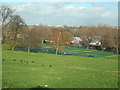
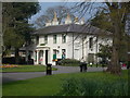
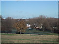
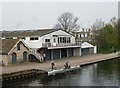

100 photos from this area
Area Information
Key information about the N16 6JH including its size, population, and administrative classification.
- Area Type
- Postcode
- Area Size
- 4197 m²
- Population
- 1988
- Population Density
- 18632 people/km²
House Prices in N16 6JH
30
Properties
£302,888
Average Sold Price
£148,000
Lowest Price
£480,000
Highest Price
Showing 30 properties
| Address | Type | Beds | Baths | Last Sale Price | Last Sale Date | |
|---|---|---|---|---|---|---|
| 50 Chardmore Road, Hackney, London, N16 6JH | house | - | - | £480,000 | Jun 2003 | |
| 46 Chardmore Road, Hackney, London, N16 6JH | house | - | - | £398,550 | Sep 2001 | |
| 64 Chardmore Road, Hackney, London, N16 6JH | Terraced | - | - | £185,000 | Nov 1998 | |
| 56 Chardmore Road, Hackney, London, N16 6JH | Terraced | - | - | £148,000 | Apr 1997 | |
| 62 Chardmore Road, Hackney, London, N16 6JH | undefined | - | - | - | - | |
| 68A, Former, 68 Chardmore Road, Hackney, London, N16 6JH | Flat | 1 | 1 | - | - | |
| Basement Flat, 54 Chardmore Road, Hackney, London, N16 6JH | Flat | - | - | - | - | |
| 66A Chardmore Road, Hackney, London, N16 6JH | Semi-detached | - | - | - | - | |
| Flat D, 68 Chardmore Road, Hackney, London, N16 6JH | Flat | - | - | - | - | |
| Flat E, 68 Chardmore Road, Hackney, London, N16 6JH | Flat | - | - | - | - |
Page 1 of 3
Energy Efficiency in N16 6JH
Amenities
Schools
| Rank | School | Type | Entry gender | Ages |
|---|
Explore more schools in this area
Go to Schools tabDemographics
Household Size
Family (3-5 people)
most common
Accommodation Type
Flats
most common
Tenure
37
majority
Ethnic Group
White
most common
Religion
N/A
most common
Household Composition
N/A
most common
Age
22
median
Adults (30-64 years)
most common
Household Deprivation
N/A
with no deprivation
NS-SEC
32
in Lower managerial occupations
Explore more demographic insights in this area
Go to Demographics tabPlanning
Planning Constraints
- Flood RiskPremium
- Ramsar Wetland SitesPremium
- Area of Outstanding Natural BeautyPremium
- Protected Nature ReservePremium
- Protected WoodlandPremium