Area Overview for N16 0NP
Photos of N16 0NP
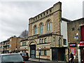
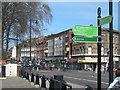
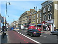
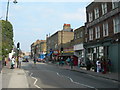
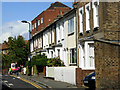
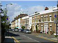
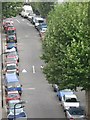
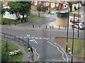
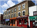
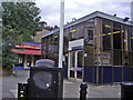

100 photos from this area
Area Information
Key information about the N16 0NP including its size, population, and administrative classification.
- Area Type
- Postcode
- Area Size
- 5481 m²
- Population
- 1756
- Population Density
- 15735 people/km²
House Prices in N16 0NP
34
Properties
£988,361
Average Sold Price
£139,000
Lowest Price
£1,900,000
Highest Price
Showing 34 properties
| Address | Type | Beds | Baths | Last Sale Price | Last Sale Date | |
|---|---|---|---|---|---|---|
| 19 Kersley Road, Hackney, London, N16 0NP | Terraced | 4 | 2 | £1,900,000 | Nov 2025 | |
| 16 Kersley Road, Hackney, London, N16 0NP | Terraced | 5 | 2 | £1,665,000 | Mar 2025 | |
| 25 Kersley Road, Hackney, London, N16 0NP | Terraced | 4 | 3 | £1,715,000 | Apr 2023 | |
| 24 Kersley Road, Hackney, London, N16 0NP | house | - | - | £1,400,000 | Mar 2021 | |
| 15 Kersley Road, Hackney, London, N16 0NP | Terraced | 5 | 1 | £1,285,000 | Mar 2021 | |
| 18 Kersley Road, Hackney, London, N16 0NP | house | 5 | 2 | £1,100,000 | Aug 2019 | |
| 12 Kersley Road, Hackney, London, N16 0NP | house | - | - | £1,075,000 | Dec 2018 | |
| 17 Kersley Road, Hackney, London, N16 0NP | Terraced | 5 | 2 | £1,225,000 | Aug 2017 | |
| 5 Kersley Road, Hackney, London, N16 0NP | Terraced | 3 | - | £1,250,000 | Jun 2016 | |
| 9 Kersley Road, Hackney, London, N16 0NP | Terraced | 5 | 2 | £1,340,000 | Jul 2015 |
Page 1 of 4
Energy Efficiency in N16 0NP
Amenities
Schools
| Rank | School | Type | Entry gender | Ages |
|---|
Explore more schools in this area
Go to Schools tabDemographics
Household Size
Family (3-5 people)
most common
Accommodation Type
Houses
most common
Tenure
62
majority
Ethnic Group
White
most common
Religion
N/A
most common
Household Composition
N/A
most common
Age
47
median
Adults (30-64 years)
most common
Household Deprivation
N/A
with no deprivation
NS-SEC
59
in Lower managerial occupations
Explore more demographic insights in this area
Go to Demographics tabPlanning
Planning Constraints
- Flood RiskPremium
- Ramsar Wetland SitesPremium
- Area of Outstanding Natural BeautyPremium
- Protected Nature ReservePremium
- Protected WoodlandPremium