Area Overview for N16 0BP
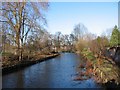
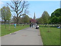
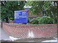
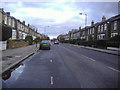
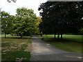
Photos of N16 0BP


Area Information
Living in N16 0BP offers a compact, residential experience within a small cluster of homes, catering to those who value convenience and proximity to London’s transport networks. With a population of 1,722, this area is tightly woven into the city’s fabric, offering residents easy access to a range of amenities. The community is predominantly composed of adults aged 30–64, reflecting a mature demographic that balances stability with urban vibrancy. Daily life here is shaped by the availability of nearby retail, rail, and metro stations, making commuting and shopping straightforward. The area’s modest size means it is ideal for those seeking a manageable, well-connected living space without the sprawl of larger suburbs. While the median age is 22, the majority of residents fall into the 30–64 bracket, suggesting a mix of long-term residents and professionals. N16 0BP’s charm lies in its accessibility, with homes primarily in flats, offering a modern, efficient lifestyle suited to those prioritising location over space.
- Area Type
- Postcode
- Area Size
- Not available
- Population
- 1722
- Population Density
- 11659 people/km²
The property market in N16 0BP is characterised by a high proportion of rental properties, with only 28% of homes owned by residents. This suggests that the area functions more as a rental market than an owner-occupied one, likely attracting tenants who prioritise location over long-term investment. The accommodation type is almost exclusively flats, which is typical for smaller, urban postcode areas. This configuration suits those seeking compact, manageable living spaces, though it may limit options for buyers seeking larger homes or gardens. The small size of N16 0BP means the housing stock is limited, but its proximity to transport hubs and amenities makes it appealing for those who value convenience over space. Buyers should consider whether the area’s rental-centric nature aligns with their long-term goals, as property values may be influenced by the local demand for short-term tenancies.
House Prices in N16 0BP
No properties found in this postcode.
Energy Efficiency in N16 0BP
Life in N16 0BP is enriched by a variety of nearby amenities, from retail to transport. Residents have access to major supermarkets such as Whole Foods Market, Morrisons, and Sainsburys, ensuring everyday shopping needs are met. The area’s proximity to rail, metro, and ferry services means commuting is seamless, with stations like Rectory Road and Arsenal offering links to key destinations. For those who prefer public transport, the nearby bus routes provide flexibility, including connections to London Victoria Coach Station. The presence of multiple transport options and retail hubs suggests a lifestyle that balances convenience with urban dynamism. Whether grabbing groceries, catching a train, or boarding a ferry, residents enjoy a well-connected, practical living environment that supports both daily routines and spontaneous exploration.
Amenities
Schools
| Rank | School | Type | Entry gender | Ages |
|---|
Explore more schools in this area
Go to Schools tabDemographics
The community in N16 0BP is defined by its age profile, with a median age of 22, though the most common age range is adults aged 30–64. This suggests a population skewed towards stability, with many residents likely established in their careers. Home ownership is relatively low, at 28%, indicating that a significant portion of the housing stock is rented. The accommodation type is predominantly flats, which aligns with the area’s compact nature and urban setting. The predominant ethnic group is White, though no specific diversity statistics are provided. The low home ownership rate may reflect the area’s appeal to renters, possibly including students or professionals seeking flexibility. The absence of detailed deprivation data means it is unclear how this affects quality of life, but the presence of amenities and transport links suggests a generally well-served community.
Household Size
Accommodation Type
Tenure
Ethnic Group
Religion
Household Composition
Age
Household Deprivation
NS-SEC
Explore more demographic insights in this area
Go to Demographics tabPlanning
Planning Constraints
- Flood RiskPremium
- Ramsar Wetland SitesPremium
- Area of Outstanding Natural BeautyPremium
- Protected Nature ReservePremium
- Protected WoodlandPremium