Area Overview for N15 6SN
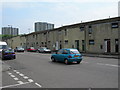
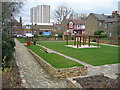
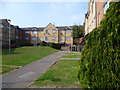
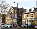
Photos of N15 6SN


Area Information
Living in N15 6SN means inhabiting a small, tightly knit residential cluster in north London, where the population of 1,694 reflects a community centred around practical living. This area is defined by its proximity to key transport hubs, including multiple rail and metro stations, which connect residents to broader London. Daily life here is shaped by the availability of retail outlets like Sainsburys Harringay and Aldi Arena, alongside ferry services to landmarks such as London Zoo. The area’s compact size ensures amenities are within practical reach, though it remains a niche postcode with limited expansion. With a median age of 47 and a population skewed toward adults aged 30–64, the community is mature, with a focus on stability. The high broadband score of 98 and strong mobile coverage support modern lifestyles, while the moderate crime risk underscores the need for standard security measures. N15 6SN is a pragmatic choice for those prioritising connectivity and convenience over sprawling urban sprawl.
- Area Type
- Postcode
- Area Size
- Not available
- Population
- 1694
- Population Density
- 20434 people/km²
The property market in N15 6SN is dominated by flats, with 18% of homes owned by residents and the remainder likely occupied by renters. This suggests a rental-focused market, where ownership is not the norm. The scarcity of owner-occupied properties may make this area less attractive to buyers seeking long-term equity, though it could be a viable option for investors targeting short-term lettings. The small residential cluster means the housing stock is limited, with little scope for expansion or redevelopment. Prospective buyers should consider the area’s compact size and the dominance of flats when evaluating potential purchases. For those prioritising rental income, the demand for flats in a well-connected postcode with nearby amenities could offer stability. However, the low home ownership rate also highlights the area’s role as a transient hub for commuters and renters rather than a destination for permanent homeowners.
House Prices in N15 6SN
No properties found in this postcode.
Energy Efficiency in N15 6SN
Life in N15 6SN is shaped by its proximity to retail, dining, and transport hubs. Nearby supermarkets like Sainsburys Harringay and Aldi Arena provide everyday essentials, while ferry stops such as London Zoo and Blackfriars Pier offer access to cultural and leisure activities. The area’s transport links ensure easy access to larger parts of London, though the immediate surroundings are more subdued. The presence of multiple rail and metro stations, including South Tottenham and Turnpike Lane, makes it convenient for commuters. While the area lacks large parks or leisure facilities, its compact size means amenities are within walking or short transit distance. The lifestyle here is practical, with a focus on connectivity and accessibility over expansive recreational spaces. Residents can enjoy a mix of urban convenience and suburban tranquillity, though the area’s character is defined more by its transport links than by standalone leisure attractions.
Amenities
Schools
| Rank | School | Type | Entry gender | Ages |
|---|
Explore more schools in this area
Go to Schools tabDemographics
The community in N15 6SN is predominantly composed of adults aged 30–64, with a median age of 47. Home ownership here is low, at just 18%, indicating that most residents are either renters or live in shared accommodation. The accommodation type is almost entirely flats, reflecting a housing stock tailored to smaller households or those seeking rental flexibility. The predominant ethnic group is White, though the data does not specify further diversity metrics. This demographic profile suggests a population focused on established careers and family life, with limited generational turnover. The low home ownership rate may impact long-term investment potential, while the prevalence of flats indicates a market more suited to tenants than buyers seeking property equity. The area’s character is shaped by its mature residents, who likely prioritise proximity to transport and amenities over property ownership.
Household Size
Accommodation Type
Tenure
Ethnic Group
Religion
Household Composition
Age
Household Deprivation
NS-SEC
Explore more demographic insights in this area
Go to Demographics tabPlanning
Planning Constraints
- Flood RiskPremium
- Ramsar Wetland SitesPremium
- Area of Outstanding Natural BeautyPremium
- Protected Nature ReservePremium
- Protected WoodlandPremium