Area Overview for N15 6LZ
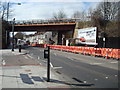
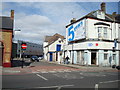
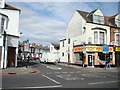
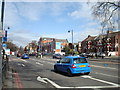
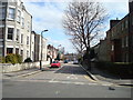
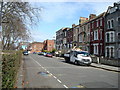
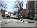
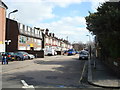
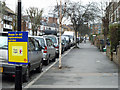
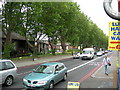
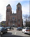
Photos of N15 6LZ

Area Information
Living in N15 6LZ offers a compact, residential experience shaped by its small cluster of homes and proximity to transport hubs. With a population of 2,103, this area is characterised by a youthful demographic, with children under 14 making up the largest age group. The low home ownership rate of 28% suggests a mix of rental properties and owner-occupied homes, reflecting a community that may include younger professionals or families seeking affordability. Daily life is influenced by the area’s connectivity: multiple rail and metro stations, including Stamford Hill and Seven Sisters, provide easy access to central London. Retail options like Sainsburys Stamford and Tesco South are within practical reach, while ferry services such as the Camden Lock Waterbus offer alternative routes. The area’s low crime risk score of 72 and absence of environmental constraints like flood zones or protected natural sites make it a practical choice for those prioritising safety and straightforward living. N15 6LZ is not a sprawling suburb but a tight-knit cluster where convenience and accessibility outweigh expansive amenities.
- Area Type
- Postcode
- Area Size
- Not available
- Population
- 2103
- Population Density
- 21975 people/km²
The property market in N15 6LZ is defined by a low home ownership rate of 28%, suggesting that the majority of housing is rented rather than owned. This aligns with a community that may include students, young professionals, or those in temporary employment. The accommodation type is predominantly houses, which is notable in a small postcode area, potentially indicating a mix of semi-detached or terraced homes. Buyers should consider that the market is likely to be competitive for owner-occupiers, with limited stock available. The presence of houses rather than flats or apartments may appeal to those seeking more space, but the small size of the area means that property choices are constrained. Prospective buyers should also factor in the area’s proximity to transport links, which may influence property values and desirability for commuters.
House Prices in N15 6LZ
No properties found in this postcode.
Energy Efficiency in N15 6LZ
Life in N15 6LZ is shaped by its proximity to a range of amenities. Retail options include Sainsburys Stamford, Sainsburys Tottenham Seven, and Tesco South, providing everyday shopping needs within walking or short-vehicle distance. The area’s rail and metro stations, such as Seven Sisters and Arsenal, connect residents to cultural and professional hubs across London. Ferry services like the Camden Lock Waterbus offer scenic routes to landmarks, including London Zoo. While the area lacks large parks or leisure facilities, its transport links ensure easy access to broader recreational opportunities. The presence of multiple retail and transport nodes suggests a practical, commuter-focused lifestyle, where convenience outweighs expansive amenities. Residents can enjoy a mix of local services and urban connectivity, making daily routines efficient.
Amenities
Schools
| Rank | School | Type | Entry gender | Ages |
|---|
Explore more schools in this area
Go to Schools tabDemographics
The population of N15 6LZ has a median age of 22, with children aged 0–14 forming the most common age group. This suggests a community skewed towards younger households, possibly including families with school-age children. Home ownership is low at 28%, indicating a rental market that may cater to students, young professionals, or those seeking temporary housing. The predominant accommodation type is houses, which is unusual for an area with such a young population, hinting at a mix of family homes and smaller properties. The predominant ethnic group is White, though specific data on diversity beyond this is not provided. The low home ownership rate may reflect economic pressures or a transient population, but the area’s safety profile and transport links suggest it is functional for those prioritising mobility over long-term investment.
Household Size
Accommodation Type
Tenure
Ethnic Group
Religion
Household Composition
Age
Household Deprivation
NS-SEC
Explore more demographic insights in this area
Go to Demographics tabPlanning
Planning Constraints
- Flood RiskPremium
- Ramsar Wetland SitesPremium
- Area of Outstanding Natural BeautyPremium
- Protected Nature ReservePremium
- Protected WoodlandPremium