Area Overview for N15 6AA
Photos of N15 6AA

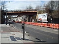
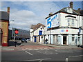
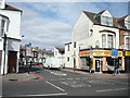
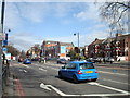
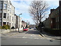
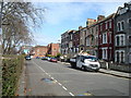
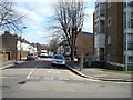
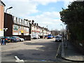
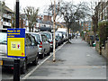
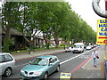

100 photos from this area
Area Information
Key information about the N15 6AA including its size, population, and administrative classification.
- Area Type
- Postcode
- Area Size
- 6181 m²
- Population
- 2103
- Population Density
- 21975 people/km²
House Prices in N15 6AA
33
Properties
£539,663
Average Sold Price
£128,000
Lowest Price
£1,050,000
Highest Price
Showing 33 properties
| Address | Type | Beds | Baths | Last Sale Price | Last Sale Date | |
|---|---|---|---|---|---|---|
| 27 Craven Park Road, Tottenham, London, N15 6AA | Terraced | 5 | 2 | £1,050,000 | Feb 2024 | |
| Former Residential, 9 Craven Park Road, Tottenham, London, N15 6AA | Flat | 2 | - | £600,000 | Mar 2018 | |
| 25 Craven Park Road, Tottenham, London, N15 6AA | house | - | - | £927,500 | Feb 2018 | |
| 11 Craven Park Road, Tottenham, London, N15 6AA | Flat | 2 | 1 | £452,220 | Apr 2016 | |
| 7 Craven Park Road, Tottenham, London, N15 6AA | Flat | - | - | £414,250 | Apr 2016 | |
| 23 Craven Park Road, Tottenham, London, N15 6AA | house | - | - | £420,000 | Nov 2011 | |
| 29 Craven Park Road, Tottenham, London, N15 6AA | house | 4 | - | £475,000 | May 2011 | |
| 37 Craven Park Road, Tottenham, London, N15 6AA | house | - | - | £390,000 | Jun 2008 | |
| 5 Craven Park Road, Tottenham, London, N15 6AA | Flat | - | - | £128,000 | Aug 2003 | |
| Flat 6, Craven Park Court, Craven Park Road, Tottenham, London, N15 6AA | Flat | - | 1 | - | - |
Page 1 of 4
Energy Efficiency in N15 6AA
Amenities
Schools
| Rank | School | Type | Entry gender | Ages |
|---|
Explore more schools in this area
Go to Schools tabDemographics
Household Size
Family (3-5 people)
most common
Accommodation Type
Houses
most common
Tenure
28
majority
Ethnic Group
White
most common
Religion
N/A
most common
Household Composition
N/A
most common
Age
22
median
Children (0-14 years)
most common
Household Deprivation
N/A
with no deprivation
NS-SEC
26
in Lower managerial occupations
Explore more demographic insights in this area
Go to Demographics tabPlanning
Planning Constraints
- Flood RiskPremium
- Ramsar Wetland SitesPremium
- Area of Outstanding Natural BeautyPremium
- Protected Nature ReservePremium
- Protected WoodlandPremium