Area Overview for N15 5DH
Photos of N15 5DH


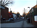
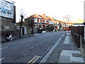
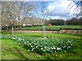
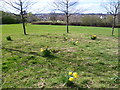
100 photos from this area
Area Information
Key information about the N15 5DH including its size, population, and administrative classification.
- Area Type
- Postcode
- Area Size
- 8973 m²
- Population
- 2550
- Population Density
- 15751 people/km²
House Prices in N15 5DH
45
Properties
£396,715
Average Sold Price
£17,500
Lowest Price
£785,000
Highest Price
Showing 45 properties
| Address | Type | Beds | Baths | Last Sale Price | Last Sale Date | |
|---|---|---|---|---|---|---|
| 25 Elmar Road, Tottenham, London, N15 5DH | Terraced | 2 | 1 | £632,500 | Mar 2025 | |
| 79 Elmar Road, Tottenham, London, N15 5DH | Terraced | 2 | 1 | £665,000 | Mar 2025 | |
| Upper Flat, 85 Elmar Road, Tottenham, London, N15 5DH | Flat | - | - | £600,000 | Oct 2024 | |
| 29 Elmar Road, Tottenham, London, N15 5DH | Terraced | 2 | 1 | £535,000 | Apr 2024 | |
| 61 Elmar Road, Tottenham, London, N15 5DH | Terraced | 3 | 2 | £735,000 | Feb 2024 | |
| 7 Elmar Road, Tottenham, London, N15 5DH | Terraced | 3 | 2 | £785,000 | Jun 2023 | |
| 39 Elmar Road, Tottenham, London, N15 5DH | house | - | - | £542,500 | Dec 2021 | |
| 81 Elmar Road, Tottenham, London, N15 5DH | Terraced | 2 | 2 | £668,750 | Apr 2021 | |
| 55 Elmar Road, Tottenham, London, N15 5DH | Terraced | 3 | 2 | £580,000 | Sep 2019 | |
| 77 Elmar Road, Tottenham, London, N15 5DH | house | 2 | 1 | £537,555 | Feb 2018 |
Page 1 of 5
Energy Efficiency in N15 5DH
Amenities
Schools
| Rank | School | Type | Entry gender | Ages |
|---|
Explore more schools in this area
Go to Schools tabDemographics
Household Size
Two person
most common
Accommodation Type
Flats
most common
Tenure
43
majority
Ethnic Group
White
most common
Religion
N/A
most common
Household Composition
N/A
most common
Age
47
median
Adults (30-64 years)
most common
Household Deprivation
N/A
with no deprivation
NS-SEC
41
in Lower managerial occupations
Explore more demographic insights in this area
Go to Demographics tabPlanning
Planning Constraints
- Flood RiskPremium
- Ramsar Wetland SitesPremium
- Area of Outstanding Natural BeautyPremium
- Protected Nature ReservePremium
- Protected WoodlandPremium