Area Overview for N15 4RD
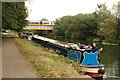
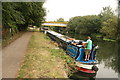
Photos of N15 4RD


Area Information
Living in N15 4RD means inhabiting a small, tightly knit residential cluster in England, where the population of 2245 residents reflects a mature community. The area’s character is shaped by its predominantly flat-based housing stock and a median age of 47, with most residents falling within the 30-64 age range. This suggests a stable, established demographic, likely centred around families or professionals in their prime working years. Daily life here is influenced by its proximity to transport hubs, with rail, metro, and bus services providing strong connectivity to nearby towns and cities. While the area’s size is modest, its strategic location near Tottenham Hale and surrounding stations ensures it is well integrated into London’s broader transport network. The low flood risk and absence of environmental constraints like AONB or protected woodlands further underline its practicality for living. For those seeking a balance between residential calm and urban accessibility, N15 4RD offers a snapshot of suburban life with a foothold in London’s dynamic infrastructure.
- Area Type
- Postcode
- Area Size
- Not available
- Population
- 2245
- Population Density
- 7549 people/km²
The property market in N15 4RD is characterised by a low home ownership rate of 29%, indicating that the majority of housing is rented rather than owned. This suggests a rental-focused market, likely catering to professionals and families seeking short- or medium-term accommodation. The predominant accommodation type is flats, which suits the area’s compact residential layout and may appeal to those prioritising convenience over larger living spaces. For buyers, this dynamic means limited opportunities for owner-occupation, with competition likely centred around a small pool of available properties. The immediate surroundings may share similar characteristics, reinforcing the area’s role as a secondary residential zone rather than a primary market for homeowners. Prospective buyers should consider the rental-centric nature of the market and its implications for long-term investment or residency.
House Prices in N15 4RD
Showing 8 properties
Energy Efficiency in N15 4RD
Daily life in N15 4RD is enriched by its proximity to a range of amenities. Retail options include Iceland Tottenham, Lidl Tottenham, and Asda Living, offering convenience for grocery shopping. The area’s transport network is a cornerstone of its lifestyle, with rail, metro, and bus services linking residents to Tottenham Hale, Wood Green, and beyond. Ferries from Camden Lock and Blackfriars Pier provide scenic alternatives for travel. While the data does not specify parks or leisure facilities, the absence of planning constraints like AONB or protected woodlands suggests open spaces may be limited. Nevertheless, the density of transport and retail options ensures a practical, accessible lifestyle. Residents can enjoy the ease of urban connectivity while benefiting from the area’s compact, service-rich environment.
Amenities
Schools
| Rank | School | Type | Entry gender | Ages |
|---|
Explore more schools in this area
Go to Schools tabDemographics
The community in N15 4RD is defined by its age profile and housing patterns. With a median age of 47 and 29% of homes owned outright, the area leans towards a mix of long-term residents and those in rental properties. The most common age group, 30-64 years, suggests a population largely in their prime working years, potentially supporting local services and amenities. Accommodation is predominantly flats, which aligns with the area’s compact nature and the lower home ownership rate. The predominant ethnic group is White, though the data does not specify further diversity metrics. The low home ownership rate implies a rental market dominates, which may influence the local economy and property dynamics. For residents, this means a community that is neither overly transient nor rigidly fixed, with a practical approach to housing that reflects its small-scale character.
Household Size
Accommodation Type
Tenure
Ethnic Group
Religion
Household Composition
Age
Household Deprivation
NS-SEC
Explore more demographic insights in this area
Go to Demographics tabPlanning
Planning Constraints
- Flood RiskPremium
- Ramsar Wetland SitesPremium
- Area of Outstanding Natural BeautyPremium
- Protected Nature ReservePremium
- Protected WoodlandPremium