Area Overview for N15 3RR
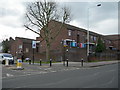
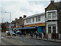
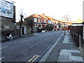
Photos of N15 3RR


Area Information
Living in N15 3RR means being part of a small, tightly knit residential cluster in north London. With a population of just 1,905, the area is compact but well-connected to surrounding districts. The community is predominantly middle-aged, with a median age of 47, and many residents fall within the 30-64 age range. This suggests a stable, established population, likely with long-term ties to the area. The postcode is characterised by a mix of urban convenience and suburban tranquillity, with easy access to transport networks and local amenities. While the area is small, its proximity to major routes like the A40 and nearby stations such as Turnpike Lane and Wood Green Station ensures it is not isolated. For those seeking a balance between city life and quieter living, N15 3RR offers a distinct identity shaped by its modest scale and practical infrastructure.
- Area Type
- Postcode
- Area Size
- Not available
- Population
- 1905
- Population Density
- 15577 people/km²
The property market in N15 3RR is shaped by its high proportion of flats and low home ownership rate. With only 37% of residents owning their homes, the area is more rental-focused than owner-occupied. This suggests that the housing stock is primarily designed for tenants rather than long-term buyers, which may affect property values and investment potential. The dominance of flats indicates a need for buyers to consider smaller, urban-style living rather than larger family homes. For those seeking to purchase in the area, the limited availability of owner-occupied properties means competition may be fierce, particularly for newer builds or properties in better condition. The small size of the postcode also means that the immediate surroundings are crucial for assessing housing options.
House Prices in N15 3RR
No properties found in this postcode.
Energy Efficiency in N15 3RR
Residents of N15 3RR enjoy a range of amenities within practical reach, enhancing daily life. The area is served by five retail outlets, including Sainsburys Haringey West and Tesco Tottenham W, providing essential shopping options. Public transport hubs like Turnpike Lane Station and Wood Green Station offer easy access to the city, while ferry services such as the Camden Lock Waterbus connect to cultural sites like London Zoo. The presence of multiple rail and metro stations ensures flexibility for commuters. For leisure, the nearby waterbus stops suggest proximity to riverside activities, though specific parks or recreational areas are not listed. The variety of retail and transport options contributes to a functional, urban lifestyle, balancing practicality with connectivity.
Amenities
Schools
Residents of N15 3RR have access to two primary schools within practical reach. West Green Primary School, rated ‘good’ by Ofsted, offers a state-led education with a focus on core academic skills. Nearby, St John Vianney RC Primary School is rated ‘outstanding’, reflecting its strong performance in both teaching quality and student outcomes. The presence of both a state and a Catholic school provides families with choices aligned with their educational and religious preferences. These institutions are likely to serve the broader local community, including children from surrounding postcodes. The high Ofsted rating at St John Vianney RC Primary School suggests it is a standout option for parents prioritising excellence in primary education.
| Rank | School | Type | Entry gender | Ages |
|---|
Explore more schools in this area
Go to Schools tabDemographics
The community in N15 3RR is defined by its age profile and housing patterns. With a median age of 47 and the majority of residents aged 30-64, the area is dominated by adults, suggesting a mature population with established careers and families. Home ownership here is relatively low, at 37%, indicating that a significant proportion of residents rent their homes. The accommodation type is predominantly flats, reflecting a housing stock suited to urban living rather than detached properties. The predominant ethnic group is White, which aligns with broader trends in the region. This demographic profile suggests a community focused on stability, with limited generational turnover. The low home ownership rate may also influence local property dynamics, making the area more rental-driven than owner-occupied.
Household Size
Accommodation Type
Tenure
Ethnic Group
Religion
Household Composition
Age
Household Deprivation
NS-SEC
Explore more demographic insights in this area
Go to Demographics tabPlanning
Planning Constraints
- Flood RiskPremium
- Ramsar Wetland SitesPremium
- Area of Outstanding Natural BeautyPremium
- Protected Nature ReservePremium
- Protected WoodlandPremium