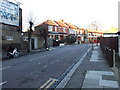
Area Overview for N15 3BW
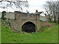
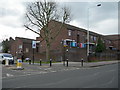
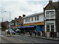
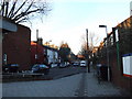
Photos of N15 3BW


Area Information
Living in N15 3BW means being part of a small, tightly knit residential cluster in north London. With a population of 1,810, the area is compact yet well-served by essential services. Daily life here is shaped by proximity to transport hubs, including Turnpike Lane and Wood Green stations, which connect residents to central London and beyond. The area’s character is defined by its mix of practical living and accessible amenities. While it is not a sprawling suburb, its density supports a range of retail options, from supermarkets like Tesco Tottenham W to local shops. The community is primarily composed of adults aged 30–64, reflecting a mature demographic that values convenience over space. For those prioritising ease of movement, the area’s transport links and digital connectivity make it appealing, though its small size means it is best suited for those content with a compact, well-connected lifestyle.
- Area Type
- Postcode
- Area Size
- Not available
- Population
- 1810
- Population Density
- 16621 people/km²
The property market in N15 3BW is characterised by a high proportion of rental properties, with only 41% of homes owned by residents. The accommodation type is predominantly flats, which aligns with the area’s small, residential cluster layout. This suggests a market skewed towards renters rather than owner-occupiers, possibly due to the limited availability of larger homes. For buyers, the small size of the area means competition is likely to be intense, with properties typically located in close proximity to transport links and amenities. The dominance of flats may also indicate a focus on affordability over space, making the area appealing to those prioritising location over property size. However, the lack of data on property prices or trends means buyers should conduct further local research.
House Prices in N15 3BW
No properties found in this postcode.
Energy Efficiency in N15 3BW
Residents of N15 3BW enjoy a range of amenities within practical reach, from retail to transport. The area is served by five retail outlets, including Tesco Tottenham W and Sainsburys Haringey West, ensuring everyday shopping needs are met. Transport options are extensive, with five metro stations, five rail stops, and ferry access at Camden Lock Waterbus. For leisure, the proximity to London Zoo Waterbus Stop offers access to green spaces and cultural attractions. The combination of supermarkets, transport hubs, and water-based connectivity creates a lifestyle that prioritises convenience and mobility. While the area lacks large parks or dining venues, its strategic location near major transport routes enhances its appeal for those seeking a balanced, functional living environment.
Amenities
Schools
Residents of N15 3BW have access to three primary schools within practical reach: Woodlands Park Junior School, Woodlands Park Infant School, and Chestnuts Primary School, which holds an Ofsted rating of ‘good’. The presence of two infant and one junior school suggests a well-structured primary education network, catering to young families. While no secondary schools are listed, the proximity to major transport routes like the Metropolitan line may provide access to broader educational options in nearby areas. The mix of school types ensures continuity for children moving through the education system, though parents should verify the specific catchment areas and admission policies.
| Rank | School | Type | Entry gender | Ages |
|---|
Explore more schools in this area
Go to Schools tabDemographics
The population of N15 3BW is 1,810, with a median age of 47. The majority of residents fall within the 30–64 age range, indicating a community of established professionals and families. Home ownership is relatively low at 41%, suggesting a higher proportion of renters. Flats dominate the accommodation type, reflecting the area’s compact nature and likely influence of nearby urban infrastructure. The predominant ethnic group is White, though no specific data on diversity or deprivation is provided. This age profile and housing stock suggest a stable, mature community with a focus on practical living. The absence of detailed diversity metrics means the area’s social fabric remains somewhat opaque, but the demographic consistency implies a cohesive local identity.
Household Size
Accommodation Type
Tenure
Ethnic Group
Religion
Household Composition
Age
Household Deprivation
NS-SEC
Explore more demographic insights in this area
Go to Demographics tabPlanning
Planning Constraints
- Flood RiskPremium
- Ramsar Wetland SitesPremium
- Area of Outstanding Natural BeautyPremium
- Protected Nature ReservePremium
- Protected WoodlandPremium