Area Overview for N14 7ND
Photos of N14 7ND


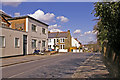
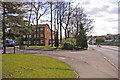
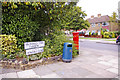


75 photos from this area
Area Information
Key information about the N14 7ND including its size, population, and administrative classification.
- Area Type
- Postcode
- Area Size
- 7095 m²
- Population
- 1511
- Population Density
- 6404 people/km²
House Prices in N14 7ND
20
Properties
£525,421
Average Sold Price
£135,000
Lowest Price
£858,000
Highest Price
Showing 20 properties
| Address | Type | Beds | Baths | Last Sale Price | Last Sale Date | |
|---|---|---|---|---|---|---|
| 21 Underne Avenue, Southgate, London, N14 7ND | Semi-detached | 4 | 2 | £858,000 | Mar 2025 | |
| 33 Underne Avenue, Southgate, London, N14 7ND | Semi-detached | 3 | 1 | £783,000 | Oct 2023 | |
| 23 Underne Avenue, Southgate, London, N14 7ND | Semi-detached | 4 | - | £792,000 | Oct 2015 | |
| 19 Underne Avenue, Southgate, London, N14 7ND | house | - | - | £489,950 | May 2011 | |
| 29 Underne Avenue, Southgate, London, N14 7ND | Semi-detached | - | - | £410,000 | Oct 2006 | |
| 27 Underne Avenue, Southgate, London, N14 7ND | Semi-detached | - | - | £210,000 | Sep 2000 | |
| 25 Underne Avenue, Southgate, London, N14 7ND | Semi-detached | - | - | £135,000 | Dec 1996 | |
| 3 Underne Avenue, Southgate, London, N14 7ND | Semi-detached | 3 | 1 | - | - | |
| 17 Underne Avenue, Southgate, London, N14 7ND | Semi-detached | 4 | 1 | - | - | |
| 15 Underne Avenue, Southgate, London, N14 7ND | Semi-detached | 3 | 1 | - | - |
Page 1 of 2
Energy Efficiency in N14 7ND
Amenities
Schools
| Rank | School | Type | Entry gender | Ages |
|---|
Explore more schools in this area
Go to Schools tabDemographics
Household Size
Family (3-5 people)
most common
Accommodation Type
Houses
most common
Tenure
84
majority
Ethnic Group
White
most common
Religion
N/A
most common
Household Composition
N/A
most common
Age
47
median
Adults (30-64 years)
most common
Household Deprivation
N/A
with no deprivation
NS-SEC
42
in Lower managerial occupations
Explore more demographic insights in this area
Go to Demographics tabPlanning
Planning Constraints
- Flood RiskPremium
- Ramsar Wetland SitesPremium
- Area of Outstanding Natural BeautyPremium
- Protected Nature ReservePremium
- Protected WoodlandPremium