Area Overview for N14 6WD
Photos of N14 6WD


Area Information
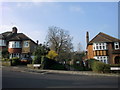
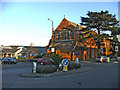
N14 6WD is a small, tightly knit residential postcode in England, home to just 1,857 people. This area is characterised by its compact size and the presence of traditional housing stock, with a focus on family-oriented living. The community is predominantly composed of adults aged 30–64, reflecting a mature, settled population. Daily life here is shaped by proximity to essential services, including a range of retail outlets and multiple transport hubs. The area’s low crime risk and absence of environmental constraints such as protected woodlands or wetlands make it an attractive option for those seeking a stable, low-maintenance lifestyle. While N14 6WD is not a sprawling suburb, its strategic location near major transport links and schools ensures it remains accessible for commuters and families alike. The modest population and focus on home ownership suggest a community that values continuity and local connection, with residents likely to be long-term residents rather than transient renters.
- Area Type
- Postcode
- Area Size
- Not available
- Population
- 1857
- Population Density
- 5267 people/km²
The property market in N14 6WD is dominated by owner-occupied homes, with 58% of properties owned by residents rather than rented. This suggests a community of long-term residents rather than a transient rental market. The accommodation type is primarily houses, which may include semi-detached or detached properties typical of suburban areas. Given the small postcode area, the housing stock is likely limited in scale, offering fewer options for buyers compared to larger towns. However, the absence of planning constraints such as protected woodlands or AONB designations may make it easier to find properties without restrictions. For buyers, this means a focus on individual homes rather than apartments, with potential for family-sized living. The market is probably more stable than volatile, reflecting the area’s mature demographic and low environmental risks.
House Prices in N14 6WD
No properties found in this postcode.
Energy Efficiency in N14 6WD
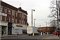
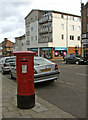
Daily life in N14 6WD is supported by a range of amenities within easy reach. Retail options include M&S Southgate, Tesco Chaseside, and Asda Southgate, offering a mix of supermarket and high-street shopping. The area’s transport links also facilitate access to leisure and dining beyond the immediate postcode. Nearby stations connect to larger centres with more extensive dining and entertainment options. While the data does not specify parks or recreational spaces, the absence of environmental constraints such as protected woodlands suggests open spaces may be available locally. The blend of retail, transport, and low environmental risk creates a lifestyle that balances convenience with a sense of community, ideal for those seeking a manageable, accessible living environment.
Amenities
Schools
Near N14 6WD are two schools catering to different educational needs. St Andrew’s Southgate Primary School (CE) is a state-funded primary school with a Good Ofsted rating, indicating a reliable foundation for early education. For independent schooling, the North London Hospital School offers an alternative, though its specific curriculum or admission criteria are not detailed. The presence of both a state and independent school provides families with choice, though the small area may limit the number of nearby options. The Good rating at St Andrew’s suggests a school that meets national standards in teaching and student outcomes. However, the absence of secondary schools in the immediate vicinity means families may need to look further afield for comprehensive education, which could be a consideration for those prioritising proximity to all stages of schooling.
| Rank | School | Type | Entry gender | Ages |
|---|
Explore more schools in this area
Go to Schools tabDemographics
The population of N14 6WD is 1,857, with a median age of 47. The majority of residents fall within the 30–64 age range, indicating a community skewed towards middle-aged adults. Home ownership is strong, with 58% of properties occupied by their owners, compared to the national average. The primary accommodation type is houses, suggesting a mix of semi-detached and detached properties. The predominant ethnic group is White, though no further breakdown of diversity is provided. This demographic profile points to a stable, long-term resident base, with fewer young families or elderly populations. The lack of specific data on deprivation or income levels means the quality of life cannot be fully assessed, but the high home ownership rate and low crime risk imply a relatively secure and self-sufficient community.
Household Size
Accommodation Type
Tenure
Ethnic Group
Religion
Household Composition
Age
Household Deprivation
NS-SEC
Explore more demographic insights in this area
Go to Demographics tabPlanning
Planning Constraints
- Flood RiskPremium
- Ramsar Wetland SitesPremium
- Area of Outstanding Natural BeautyPremium
- Protected Nature ReservePremium
- Protected WoodlandPremium