Area Overview for N14 6RL
Photos of N14 6RL
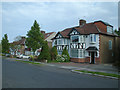
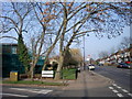
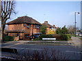
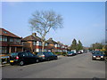
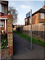
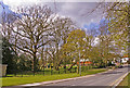
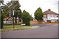
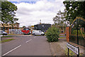
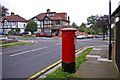
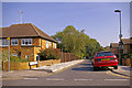
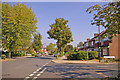
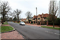
100 photos from this area
Area Information
Key information about the N14 6RL including its size, population, and administrative classification.
- Area Type
- Postcode
- Area Size
- 1.1 hectares
- Population
- 1857
- Population Density
- 5267 people/km²
House Prices in N14 6RL
23
Properties
£659,494
Average Sold Price
£268,000
Lowest Price
£1,050,000
Highest Price
Showing 23 properties
| Address | Type | Beds | Baths | Last Sale Price | Last Sale Date | |
|---|---|---|---|---|---|---|
| 74 Wynchgate, Southgate, N14 6RL | Semi-detached | 4 | 1 | £1,050,000 | Dec 2025 | |
| 40 Wynchgate, Southgate, N14 6RL | Semi-detached | 3 | 1 | £927,500 | Feb 2024 | |
| 34 Wynchgate, Southgate, N14 6RL | Semi-detached | 3 | 2 | £900,000 | Dec 2020 | |
| 56 Wynchgate, Southgate, N14 6RL | house | - | - | £745,000 | Nov 2018 | |
| 58 Wynchgate, Southgate, N14 6RL | house | - | - | £920,000 | Aug 2016 | |
| 70 Wynchgate, Southgate, N14 6RL | Flat | - | - | £360,000 | Mar 2016 | |
| 44 Wynchgate, Southgate, N14 6RL | Semi-detached | - | - | £475,000 | Jan 2013 | |
| 54 Wynchgate, Southgate, N14 6RL | house | - | - | £289,950 | Aug 2000 | |
| 46 Wynchgate, Southgate, N14 6RL | Semi-detached | - | - | £268,000 | Mar 2000 | |
| 70-70-A Wynchgate, Southgate, N14 6RL | Flat | - | - | - | - |
Page 1 of 3
Energy Efficiency in N14 6RL
Amenities
Schools
| Rank | School | Type | Entry gender | Ages |
|---|
Explore more schools in this area
Go to Schools tabDemographics
Household Size
Family (3-5 people)
most common
Accommodation Type
Houses
most common
Tenure
58
majority
Ethnic Group
White
most common
Religion
N/A
most common
Household Composition
N/A
most common
Age
47
median
Adults (30-64 years)
most common
Household Deprivation
N/A
with no deprivation
NS-SEC
37
in Lower managerial occupations
Explore more demographic insights in this area
Go to Demographics tabPlanning
Planning Constraints
- Flood RiskPremium
- Ramsar Wetland SitesPremium
- Area of Outstanding Natural BeautyPremium
- Protected Nature ReservePremium
- Protected WoodlandPremium