Area Overview for N14 6QS
Photos of N14 6QS
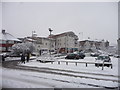
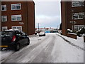
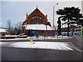
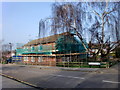
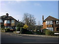
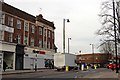
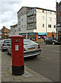
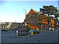
100 photos from this area
Area Information
Key information about the N14 6QS including its size, population, and administrative classification.
- Area Type
- Postcode
- Area Size
- 1.6 hectares
- Population
- 1875
- Population Density
- 3874 people/km²
House Prices in N14 6QS
17
Properties
£546,750
Average Sold Price
£102,500
Lowest Price
£1,550,000
Highest Price
Showing 17 properties
| Address | Type | Beds | Baths | Last Sale Price | Last Sale Date | |
|---|---|---|---|---|---|---|
| 30 The Bourne, Southgate, N14 6QS | Semi-detached | 4 | 1 | £1,020,000 | Mar 2021 | |
| 50 The Bourne, Southgate, N14 6QS | Detached | 5 | 4 | £1,550,000 | Nov 2020 | |
| 34 The Bourne, Southgate, N14 6QS | Terraced | - | - | £102,500 | Aug 2011 | |
| 36 The Bourne, Southgate, N14 6QS | house | - | - | £640,000 | Apr 2010 | |
| 38 The Bourne, Southgate, N14 6QS | Detached | - | - | £560,000 | Aug 2006 | |
| 48 The Bourne, Southgate, N14 6QS | Detached | - | - | £215,000 | Nov 1996 | |
| 24 The Bourne, Southgate, N14 6QS | Terraced | - | - | £141,500 | Feb 1996 | |
| 42 The Bourne, Southgate, N14 6QS | Semi-detached | - | - | £145,000 | Jun 1995 | |
| 50A The Bourne, Southgate, N14 6QS | Flat | 1 | 1 | - | - | |
| 40 The Bourne, Southgate, N14 6QS | Semi-detached | - | - | - | - |
Page 1 of 2
Energy Efficiency in N14 6QS
Amenities
Schools
| Rank | School | Type | Entry gender | Ages |
|---|
Explore more schools in this area
Go to Schools tabDemographics
Household Size
Family (3-5 people)
most common
Accommodation Type
Houses
most common
Tenure
63
majority
Ethnic Group
White
most common
Religion
N/A
most common
Household Composition
N/A
most common
Age
47
median
Adults (30-64 years)
most common
Household Deprivation
N/A
with no deprivation
NS-SEC
45
in Lower managerial occupations
Explore more demographic insights in this area
Go to Demographics tabPlanning
Planning Constraints
- Flood RiskPremium
- Ramsar Wetland SitesPremium
- Area of Outstanding Natural BeautyPremium
- Protected Nature ReservePremium
- Protected WoodlandPremium