Area Overview for N14 6HR
Photos of N14 6HR
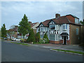
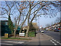
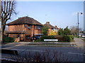
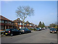
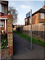
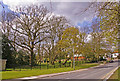
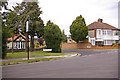
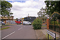
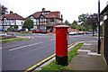
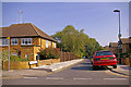
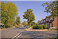
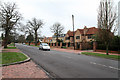
100 photos from this area
Area Information
Key information about the N14 6HR including its size, population, and administrative classification.
- Area Type
- Postcode
- Area Size
- 1.2 hectares
- Population
- 1608
- Population Density
- 5658 people/km²
House Prices in N14 6HR
26
Properties
£458,159
Average Sold Price
£145,000
Lowest Price
£1,078,000
Highest Price
Showing 26 properties
| Address | Type | Beds | Baths | Last Sale Price | Last Sale Date | |
|---|---|---|---|---|---|---|
| 43 The Vale, Southgate, N14 6HR | house | 3 | 2 | £1,020,000 | Oct 2022 | |
| 15 The Vale, Southgate, N14 6HR | Detached | 5 | 4 | £790,000 | Sep 2022 | |
| 23 The Vale, Southgate, N14 6HR | house | - | - | £915,000 | Feb 2022 | |
| 9 The Vale, Southgate, N14 6HR | Detached | 5 | 4 | £1,078,000 | Jul 2019 | |
| 25 The Vale, Southgate, N14 6HR | Semi-detached | 3 | - | £500,000 | Jan 2014 | |
| 45 The Vale, Southgate, N14 6HR | house | - | - | £445,000 | Apr 2012 | |
| 55 The Vale, Southgate, N14 6HR | house | - | - | £500,000 | Aug 2008 | |
| 39 The Vale, Southgate, N14 6HR | Terraced | - | - | £158,550 | Sep 2006 | |
| 57 The Vale, Southgate, N14 6HR | Semi-detached | - | - | £472,500 | Jun 2006 | |
| 13 The Vale, Southgate, N14 6HR | Terraced | - | - | £355,000 | Feb 2005 |
Page 1 of 3
Energy Efficiency in N14 6HR
Amenities
Schools
| Rank | School | Type | Entry gender | Ages |
|---|
Explore more schools in this area
Go to Schools tabDemographics
Household Size
Family (3-5 people)
most common
Accommodation Type
Houses
most common
Tenure
80
majority
Ethnic Group
White
most common
Religion
N/A
most common
Household Composition
N/A
most common
Age
47
median
Adults (30-64 years)
most common
Household Deprivation
N/A
with no deprivation
NS-SEC
41
in Lower managerial occupations
Explore more demographic insights in this area
Go to Demographics tabPlanning
Planning Constraints
- Flood RiskPremium
- Ramsar Wetland SitesPremium
- Area of Outstanding Natural BeautyPremium
- Protected Nature ReservePremium
- Protected WoodlandPremium