Area Overview for N14 6EQ
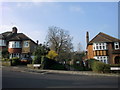
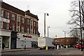
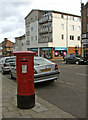
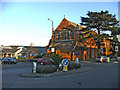
Photos of N14 6EQ


Area Information
Living in N14 6EQ means inhabiting a compact residential cluster in north London, where the population of 1,654 residents creates a tightly knit community. This area is characterised by its focus on flats, reflecting a housing stock tailored to smaller households or those prioritising urban convenience. The median age of 47 suggests a mature demographic, with adults aged 30–64 forming the majority. Proximity to Southgate College, a sixth-form institution, and multiple transport hubs such as Southgate and Arnos Grove stations highlights the area’s accessibility for commuters and students. Daily life here balances suburban tranquillity with urban connectivity, with nearby retail outlets like Tesco Chaseside and Asda Southgate providing essential services. While the area lacks primary or secondary schools, its strategic location near larger educational institutions may appeal to families seeking broader options. The low flood risk and absence of environmental constraints like AONB or protected woodlands suggest a stable, practical living environment, though the high crime risk remains a critical consideration for residents.
- Area Type
- Postcode
- Area Size
- Not available
- Population
- 1654
- Population Density
- 8140 people/km²
The property market in N14 6EQ is defined by its low home ownership rate of 28%, indicating that the majority of residents rent rather than own their homes. The accommodation type is almost exclusively flats, which are typically smaller and suited to individuals or couples rather than larger families. This suggests a housing stock that prioritises urban living and proximity to transport over spacious, family-oriented homes. For buyers, the area’s small size and limited owner-occupied properties mean competition for available flats may be fierce. Those seeking owner-occupied homes might need to look beyond N14 6EQ’s immediate surroundings, where larger housing options or lower property density could provide more choice. The rental market here is likely to be competitive, with demand driven by commuters and students benefiting from the area’s transport links.
House Prices in N14 6EQ
No properties found in this postcode.
Energy Efficiency in N14 6EQ
The lifestyle in N14 6EQ is shaped by its proximity to retail, transport, and communal spaces. Nearby shops such as Tesco Chaseside, M&S Southgate, and Asda Southgate provide everyday essentials, while the area’s five metro and rail stations offer seamless access to London’s suburbs and central districts. Though the data does not mention parks or leisure facilities, the presence of multiple transport hubs suggests a focus on mobility over green spaces. The community’s character is defined by its practicality, with amenities designed for efficiency rather than leisure. Residents can enjoy the convenience of nearby shopping and transport, though those seeking extensive recreational areas may need to venture further afield. The compact nature of the area means daily life revolves around these core services, creating a functional but not expansive living environment.
Amenities
Schools
The nearest educational institution to N14 6EQ is Southgate College, a sixth-form college offering post-16 education. However, no primary or secondary schools are listed in the data, meaning families with younger children would need to look further afield for schooling options. The absence of local schools suggests that the area functions more as a commuter or student hub than a family-centric neighbourhood. For those requiring sixth-form education, Southgate College provides access to higher-level studies, though its specific Ofsted rating is not provided. This lack of local school infrastructure may influence decisions about where to live, with residents relying on nearby areas for primary and secondary education.
| Rank | School | Type | Entry gender | Ages |
|---|
Explore more schools in this area
Go to Schools tabDemographics
The community in N14 6EQ is predominantly composed of adults aged 30–64, with a median age of 47. Home ownership stands at 28%, indicating a rental market that dominates the area. The accommodation type is almost entirely flats, reflecting a housing stock suited to smaller households or those prioritising proximity to transport links. The predominant ethnic group is White, though no data is provided on other demographics. The low home ownership rate suggests a transient population, potentially influenced by the area’s role as a commuter hub. This demographic profile shapes a community where stability is balanced with mobility, with residents often relying on nearby amenities rather than local services. The absence of specific data on deprivation or socioeconomic diversity means the area’s quality of life is inferred from its infrastructure and connectivity rather than detailed socioeconomic metrics.
Household Size
Accommodation Type
Tenure
Ethnic Group
Religion
Household Composition
Age
Household Deprivation
NS-SEC
Explore more demographic insights in this area
Go to Demographics tabPlanning
Planning Constraints
- Flood RiskPremium
- Ramsar Wetland SitesPremium
- Area of Outstanding Natural BeautyPremium
- Protected Nature ReservePremium
- Protected WoodlandPremium