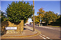
Area Overview for N14 6EL
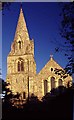
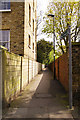
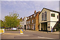
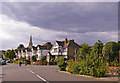
Photos of N14 6EL


Area Information
Living in N14 6EL offers a distinctly mature residential experience within a compact footprint. This specific postcode covers a small residential cluster measuring just 2,081 square metres, creating an immediate sense of intimacy and exclusivity. With a total population of 1,875 residents, the area maintains a tightly knit character where neighbours are likely to know each other. The low density of 901,025 people per square kilometre suggests a quiet environment suited to those who prioritise space and reduced noise over proximity to major city centres. You can expect a neighbourhood defined by its limited scale, which fosters a community atmosphere distinct from the sprawling suburbs often found elsewhere in Greater London. The layout supports a lifestyle where daily needs are accessible, yet the setting remains sheltered and private. This small area functions as a self-contained hub for the approximately 1,900 people who call it home, providing a stable and predictable environment for settling down.
- Area Type
- Postcode
- Area Size
- 2081 m²
- Population
- 1875
- Population Density
- 3874 people/km²
The property market in N14 6EL is characterised by a strong preference for ownership over renting. With 63% of households being owner-occupied, the area functions as a stable, established housing stock rather than a transient rental market. You will find that homes in this postcode are predominantly houses, providing a consistent architectural identity and ample living space for families. This high level of home ownership suggests that many residents have chosen this specific cluster for its suitability to long-term living plans. The small size of the area, encompassing only 2,081 square metres, means that the supply of properties is limited compared to wider boroughs. Consequently, buyers looking for a house in N14 6EL may encounter a competitive environment due to the scarcity of larger family homes in such a confined residential zone. The market reflects the needs of adults aged 30 to 64 who have moved beyond the rental sector.
House Prices in N14 6EL
Showing 10 properties
| Address | Type | Beds | Baths | Last Sale Price | Last Sale Date | |
|---|---|---|---|---|---|---|
| 10, White House Court, High Street, Southgate, N14 6EL | Flat | - | - | - | - | |
| 6, White House Court, High Street, Southgate, N14 6EL | Flat | - | - | - | - | |
| 2, White House Court, High Street, Southgate, N14 6EL | Flat | - | - | - | - | |
| 7, White House Court, High Street, Southgate, N14 6EL | Flat | - | - | - | - | |
| 1, White House Court, High Street, Southgate, N14 6EL | Flat | 2 | 1 | - | - | |
| 5, White House Court, High Street, Southgate, N14 6EL | Flat | - | - | - | - | |
| 9, White House Court, High Street, Southgate, N14 6EL | Flat | - | - | - | - | |
| 8, White House Court, High Street, Southgate, N14 6EL | Maisonette | 2 | - | - | - | |
| 3, White House Court, High Street, Southgate, N14 6EL | Flat | - | - | - | - | |
| 4, White House Court, High Street, Southgate, N14 6EL | Maisonette | - | - | - | - |
Energy Efficiency in N14 6EL
Daily life in N14 6EL benefits from a convenient sphere of amenities located within practical reach. Retail options include Cook Southgate, M&S Southgate SF, and Tesco Chaseside, providing essential shopping needs alongside quality groceries. Transport links are well-established with five metro stations identified, including Southgate, Arnos Grove, and Bounds Green, alongside rail connections at Palmers Green, Winchmore Hill, and New Southgate. These stations offer direct routes into central London for commuting or leisure. One ferry service, the Camden Lock Waterbus, is also accessible, adding variety to your travel options. Proximity to these facilities means you do not need to venture far for daily purchases or weekend trips. The combination of high-street retail and multiple rail hubs creates a lifestyle where convenience meets variety, ensuring that residents of N14 6EL have immediate access to a wide range of services.
Amenities
Schools
Families residing in N14 6EL have access to Walker Primary School, which is located within convenient reach of the postcode. This institution operates as a primary school and holds an Ofsted rating of good, reflecting a standard of education recognised by the Department for Education. The presence of a single rated school in the immediate vicinity suggests a reliance on local attendance zones for younger children. Parents in N14 6EL will appreciate the clear quality assurance associated with the school's rating, knowing that their children are enrolled in an environment meeting national standards. While the data highlights only primary-level provisions directly adjacent to the cluster, the good rating provides a solid foundation for families seeking early education options. The proximity of Walker Primary School ensures that daily school runs are short and manageable for residents of this small residential cluster.
| Rank | School | Type | Entry gender | Ages |
|---|
Explore more schools in this area
Go to Schools tabDemographics
The community in N14 6EL reflects a settled, middle-aged population with a median age of 47 years. Most residents fall into the adult category aged between 30 and 64 years, indicating a neighbourhood dominated by established households rather than young professionals or retirees. Home ownership stands at a high rate of 63%, confirming that the majority of people living here own their properties outright or with a mortgage alongside their families. The predominant ethnic group in this cluster is White, mirroring the broader demographic profile of the immediate North London postcode surroundings. Accommodation throughout N14 6EL consists primarily of houses, aligning with the desire for private gardens and separated living spaces common in households of this age profile. This housing stock accommodates the specific needs of long-term residents who value stability and space within their immediate 2,000-square-metre territory.
Household Size
Accommodation Type
Tenure
Ethnic Group
Religion
Household Composition
Age
Household Deprivation
NS-SEC
Explore more demographic insights in this area
Go to Demographics tabPlanning
Planning Constraints
- Flood RiskPremium
- Ramsar Wetland SitesPremium
- Area of Outstanding Natural BeautyPremium
- Protected Nature ReservePremium
- Protected WoodlandPremium