Area Overview for N14 6BQ
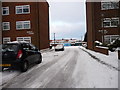
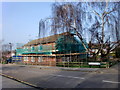
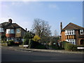
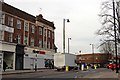
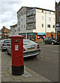
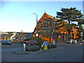
Photos of N14 6BQ


Area Information
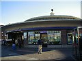
Living in N14 6BQ means being part of a small, tightly knit residential cluster in north London. With a population of 1,654, the area is compact yet well-served by transport and amenities. The community is predominantly composed of adults aged 30–64, reflecting a mature demographic. While the area’s housing stock is largely flats, the 28% home ownership rate suggests a mix of renters and long-term residents. Daily life here is shaped by proximity to key services: five metro stations, including Southgate and Arnos Grove, ensure easy access to nearby towns, while retail options like Tesco Chaseside and Asda Southgate cater to everyday needs. The broadband score of 87 and mobile coverage of 85 mean most residents can work remotely or stay connected. However, the area’s safety profile has a critical caveat: crime rates are above average, with a safety score of 2. Despite this, N14 6BQ remains a practical choice for those prioritising transport links and convenience over low-risk environments.
- Area Type
- Postcode
- Area Size
- Not available
- Population
- 1654
- Population Density
- 8140 people/km²
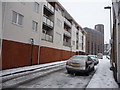
The property market in N14 6BQ is characterised by a low home ownership rate of 28%, indicating that the majority of housing is rented. The accommodation type is predominantly flats, which suits the area’s small scale and density. This suggests a rental-focused market, with limited opportunities for owner-occupiers seeking detached or semi-detached homes. Buyers considering the area should note that flats may be the only viable option, though their availability could be constrained by the postcode’s limited size. The proximity to transport hubs like Southgate and Palmers Green stations may appeal to commuters, but the high crime risk score of 2 could deter some buyers. For those prioritising location over property type, the area’s compact nature means nearby towns offer more varied housing stock.
House Prices in N14 6BQ
No properties found in this postcode.
Energy Efficiency in N14 6BQ
Life in N14 6BQ is shaped by its proximity to retail and transport hubs. The area’s five retail venues, including Tesco Chaseside and Asda Southgate, provide access to groceries, clothing, and everyday essentials. Metro and rail stations like Southgate and Winchmore Hill ensure quick travel to nearby towns, enhancing convenience for shopping, dining, or leisure. While the data does not mention parks or recreational spaces, the presence of multiple transport options suggests the area is well-integrated into surrounding amenities. The compact nature of N14 6BQ means residents may need to venture slightly further for larger leisure facilities, but the immediate vicinity offers sufficient daily conveniences.
Amenities
Schools
The nearest school to N14 6BQ is Southgate College, a sixth-form institution. No other schools are listed in the data, meaning families with younger children may need to look beyond the immediate area for primary or secondary education. Southgate College caters to older students, offering post-16 education and vocational training. This suggests the area is more suited to those with teenagers or young adults requiring further education. The absence of primary or secondary schools within the postcode implies that residents may rely on nearby towns for school placements, which could impact convenience for families.
| Rank | School | Type | Entry gender | Ages |
|---|
Explore more schools in this area
Go to Schools tabDemographics
The community in N14 6BQ is defined by its age profile and household composition. The median age of 47, with the most common age range being 30–64, indicates a population of working-age adults and older residents. Home ownership is relatively low at 28%, suggesting a higher proportion of renters, possibly including students or professionals seeking short-term housing. The predominant accommodation type is flats, which aligns with the area’s compact footprint. Ethnically, the population is predominantly White, though no specific data on diversity or deprivation is provided. The absence of protected natural areas or wetlands means the area is free from planning constraints that might limit development. However, the high crime risk score of 2 highlights a potential challenge for residents, particularly in terms of personal safety and property security.
Household Size
Accommodation Type
Tenure
Ethnic Group
Religion
Household Composition
Age
Household Deprivation
NS-SEC
Explore more demographic insights in this area
Go to Demographics tabPlanning
Planning Constraints
- Flood RiskPremium
- Ramsar Wetland SitesPremium
- Area of Outstanding Natural BeautyPremium
- Protected Nature ReservePremium
- Protected WoodlandPremium