Area Overview for N14 5PF
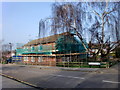
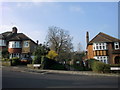
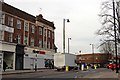
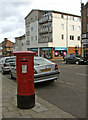
Photos of N14 5PF


Area Information
Living in N14 5PF means being part of a small, tightly knit residential cluster in north London, where the population of 1,793 residents reflects a stable, family-oriented community. This area is characterised by its proximity to transport hubs and a mix of retail and educational facilities, making it practical for daily life. The median age of 47 suggests a mature demographic, with many residents in their 30s to 60s, creating a sense of continuity and familiarity. While the area is compact, it offers access to essential amenities within walking or short driving distance. The presence of multiple schools, including Ashmole Academy and Ashmole Primary School, underscores its appeal to families. Residents benefit from low crime rates and excellent broadband connectivity, ensuring both safety and modern convenience. N14 5PF is not a sprawling suburb but a focused neighbourhood where local services and community ties are central to the experience of living here.
- Area Type
- Postcode
- Area Size
- Not available
- Population
- 1793
- Population Density
- 4512 people/km²
The property market in N14 5PF is dominated by owner-occupied homes, with 77% of residents living in properties they own. This contrasts with areas where rental markets dominate, indicating a community of long-term residents rather than transient tenants. The accommodation type is primarily houses, which are more common than flats or apartments in this postcode. This suggests a focus on traditional, family-friendly housing stock, likely with gardens or larger living spaces. Given the area’s small size, the housing market is limited in scope, with fewer properties available compared to larger urban areas. For buyers, this means competition may be higher, and the selection of homes is constrained to a specific cluster of properties. The predominance of houses also implies that the area is less suited to those seeking high-density living or rental investments.
House Prices in N14 5PF
No properties found in this postcode.
Energy Efficiency in N14 5PF
The lifestyle in N14 5PF is shaped by its proximity to retail, dining, and transport hubs. Residents have access to notable shops such as Tesco Chaseside, Asda Southgate, and M&S Southgate SF, offering a range of grocery and retail options. The area’s transport network includes multiple metro and rail stations, such as Arnos Grove and Palmers Green, facilitating quick travel to nearby towns or London’s core. While the data does not specify parks or leisure facilities, the presence of multiple retail and transport options suggests a practical, convenience-driven daily life. The mix of supermarkets, shops, and stations ensures that essentials are within reach, supporting a lifestyle that balances local amenities with broader connectivity.
Amenities
Schools
Residents of N14 5PF have access to three schools within proximity: Ashmole School, a primary school; Ashmole Academy, an academy with an Ofsted rating of ‘good’; and Ashmole Primary School, which holds an ‘outstanding’ rating. The presence of both primary and academy schools offers families a choice between traditional state education and the structured approach of academy-led institutions. The ‘outstanding’ rating at Ashmole Primary School is a strong indicator of high-quality teaching and facilities, which can be a deciding factor for families prioritising educational standards. The mix of school types may appeal to those seeking a balance between established local schools and newer, academically focused institutions. With no mention of nursery or secondary schools in the data, the area’s educational offerings are focused on primary and early secondary education.
| Rank | School | Type | Entry gender | Ages |
|---|
Explore more schools in this area
Go to Schools tabDemographics
The community in N14 5PF is predominantly composed of adults aged 30–64, with a median age of 47. This suggests a population that is largely established, with many residents likely to be in their prime working years or nearing retirement. Home ownership is high at 77%, indicating a strong presence of owner-occupied properties, which contributes to a sense of stability. The accommodation type is primarily houses, rather than flats or apartments, which aligns with the area’s residential character. The predominant ethnic group is White, reflecting a homogenous demographic profile. While no specific data on deprivation is provided, the high home ownership and low crime risk suggest a relatively affluent and secure environment. The absence of detailed diversity metrics means the community’s social fabric is less defined in terms of cultural or ethnic variation.
Household Size
Accommodation Type
Tenure
Ethnic Group
Religion
Household Composition
Age
Household Deprivation
NS-SEC
Explore more demographic insights in this area
Go to Demographics tabPlanning
Planning Constraints
- Flood RiskPremium
- Ramsar Wetland SitesPremium
- Area of Outstanding Natural BeautyPremium
- Protected Nature ReservePremium
- Protected WoodlandPremium