Area Overview for N14 5NA
Photos of N14 5NA


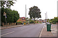
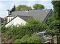
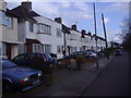

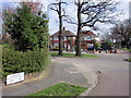
100 photos from this area
Area Information
Key information about the N14 5NA including its size, population, and administrative classification.
- Area Type
- Postcode
- Area Size
- 5311 m²
- Population
- 1395
- Population Density
- 5091 people/km²
House Prices in N14 5NA
13
Properties
£438,425
Average Sold Price
£185,000
Lowest Price
£815,000
Highest Price
Showing 13 properties
| Address | Type | Beds | Baths | Last Sale Price | Last Sale Date | |
|---|---|---|---|---|---|---|
| 32 Monkfrith Way, Southgate, London, N14 5NA | Detached | 4 | 2 | £815,000 | Dec 2016 | |
| 8 Monkfrith Way, Southgate, London, N14 5NA | Semi-detached | 3 | - | £799,950 | Nov 2016 | |
| 22 Monkfrith Way, Southgate, London, N14 5NA | house | - | - | £477,500 | Apr 2010 | |
| 10 Monkfrith Way, Southgate, London, N14 5NA | Semi-detached | - | - | £399,950 | Feb 2003 | |
| 24 Monkfrith Way, Southgate, London, N14 5NA | house | - | - | £400,000 | May 2002 | |
| 20 Monkfrith Way, Southgate, London, N14 5NA | Semi-detached | - | - | £215,000 | Mar 1998 | |
| 30 Monkfrith Way, Southgate, London, N14 5NA | Detached | - | - | £215,000 | Oct 1996 | |
| 12 Monkfrith Way, Southgate, London, N14 5NA | Semi-detached | - | - | £185,000 | Sep 1995 | |
| 28 Monkfrith Way, Southgate, London, N14 5NA | Detached | - | - | - | - | |
| 26 Monkfrith Way, Southgate, London, N14 5NA | Detached | - | - | - | - |
Page 1 of 2
Energy Efficiency in N14 5NA
Amenities
Schools
| Rank | School | Type | Entry gender | Ages |
|---|
Explore more schools in this area
Go to Schools tabDemographics
Household Size
Family (3-5 people)
most common
Accommodation Type
Houses
most common
Tenure
91
majority
Ethnic Group
White
most common
Religion
N/A
most common
Household Composition
N/A
most common
Age
47
median
Adults (30-64 years)
most common
Household Deprivation
N/A
with no deprivation
NS-SEC
43
in Lower managerial occupations
Explore more demographic insights in this area
Go to Demographics tabPlanning
Planning Constraints
- Flood RiskPremium
- Ramsar Wetland SitesPremium
- Area of Outstanding Natural BeautyPremium
- Protected Nature ReservePremium
- Protected WoodlandPremium