Area Overview for N14 5LT
Photos of N14 5LT
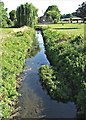


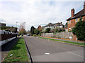
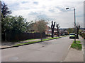
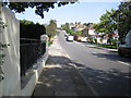

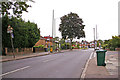
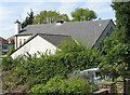
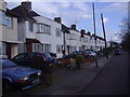

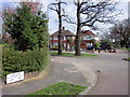
100 photos from this area
Area Information
Key information about the N14 5LT including its size, population, and administrative classification.
- Area Type
- Postcode
- Area Size
- 9102 m²
- Population
- 1395
- Population Density
- 5091 people/km²
House Prices in N14 5LT
26
Properties
£355,523
Average Sold Price
£1,750
Lowest Price
£860,000
Highest Price
Showing 26 properties
| Address | Type | Beds | Baths | Last Sale Price | Last Sale Date | |
|---|---|---|---|---|---|---|
| 8 Knoll Drive, Southgate, London, N14 5LT | Semi-detached | 3 | 1 | £860,000 | Mar 2025 | |
| 42 Knoll Drive, Southgate, London, N14 5LT | Flat | 2 | 2 | £650,000 | May 2022 | |
| 36 Knoll Drive, Southgate, London, N14 5LT | Semi-detached | 3 | 1 | £1,750 | Jan 2021 | |
| 38 Knoll Drive, Southgate, London, N14 5LT | Semi-detached | 3 | - | £670,000 | Jan 2015 | |
| 14 Knoll Drive, Southgate, London, N14 5LT | house | 3 | - | £402,000 | May 2011 | |
| 48 Knoll Drive, Southgate, London, N14 5LT | house | - | - | £315,000 | Jan 2005 | |
| 6 Knoll Drive, Southgate, London, N14 5LT | Semi-detached | - | - | £310,000 | Jun 2004 | |
| 40A Knoll Drive, Southgate, London, N14 5LT | Detached | - | - | £250,000 | Jan 2001 | |
| 22 Knoll Drive, Southgate, London, N14 5LT | Semi-detached | - | - | £170,000 | Sep 1998 | |
| 18 Knoll Drive, Southgate, London, N14 5LT | Semi-detached | - | - | £135,000 | Sep 1997 |
Page 1 of 3
Energy Efficiency in N14 5LT
Amenities
Schools
| Rank | School | Type | Entry gender | Ages |
|---|
Explore more schools in this area
Go to Schools tabDemographics
Household Size
Family (3-5 people)
most common
Accommodation Type
Houses
most common
Tenure
91
majority
Ethnic Group
White
most common
Religion
N/A
most common
Household Composition
N/A
most common
Age
47
median
Adults (30-64 years)
most common
Household Deprivation
N/A
with no deprivation
NS-SEC
43
in Lower managerial occupations
Explore more demographic insights in this area
Go to Demographics tabPlanning
Planning Constraints
- Flood RiskPremium
- Ramsar Wetland SitesPremium
- Area of Outstanding Natural BeautyPremium
- Protected Nature ReservePremium
- Protected WoodlandPremium