Area Overview for N14 5HD
Photos of N14 5HD

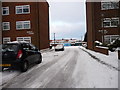
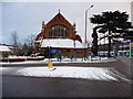
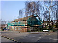
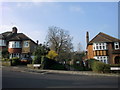
100 photos from this area
Area Information
Key information about the N14 5HD including its size, population, and administrative classification.
- Area Type
- Postcode
- Area Size
- 1.4 hectares
- Population
- 1395
- Population Density
- 5091 people/km²
House Prices in N14 5HD
27
Properties
£392,722
Average Sold Price
£72,000
Lowest Price
£1,075,000
Highest Price
Showing 27 properties
| Address | Type | Beds | Baths | Last Sale Price | Last Sale Date | |
|---|---|---|---|---|---|---|
| 131 Chase Side, Southgate, N14 5HD | Semi-detached | 4 | 4 | £1,075,000 | Mar 2025 | |
| 121A Chase Side, Southgate, N14 5HD | Maisonette | - | - | £290,000 | Mar 2017 | |
| 125 Chase Side, Southgate, N14 5HD | Terraced | 4 | 1 | £650,000 | Jun 2012 | |
| 111 Chase Side, Southgate, N14 5HD | house | 3 | - | £320,000 | Jul 2011 | |
| 133 Chase Side, Southgate, N14 5HD | Semi-detached | - | - | £460,000 | Jul 2004 | |
| 123A Chase Side, Southgate, N14 5HD | Maisonette | 3 | 1 | £227,500 | Aug 2001 | |
| 139 Chase Side, Southgate, N14 5HD | Semi-detached | 4 | 2 | £250,000 | Mar 2000 | |
| 109 Chase Side, Southgate, N14 5HD | Terraced | - | - | £72,000 | Oct 1998 | |
| 129 Chase Side, Southgate, N14 5HD | Semi-detached | - | - | £190,000 | Jun 1997 | |
| 127 Chase Side, Southgate, N14 5HD | Detached | 4 | 1 | - | - |
Page 1 of 3
Energy Efficiency in N14 5HD
Amenities
Schools
| Rank | School | Type | Entry gender | Ages |
|---|
Explore more schools in this area
Go to Schools tabDemographics
Household Size
Family (3-5 people)
most common
Accommodation Type
Houses
most common
Tenure
91
majority
Ethnic Group
White
most common
Religion
N/A
most common
Household Composition
N/A
most common
Age
47
median
Adults (30-64 years)
most common
Household Deprivation
N/A
with no deprivation
NS-SEC
43
in Lower managerial occupations
Explore more demographic insights in this area
Go to Demographics tabPlanning
Planning Constraints
- Flood RiskPremium
- Ramsar Wetland SitesPremium
- Area of Outstanding Natural BeautyPremium
- Protected Nature ReservePremium
- Protected WoodlandPremium